Rain was forecast everyday around this weekend, so taking the better of all the days we headed out for a couple of shorter walks in the same area - both Neolithic in origin. We parked at a small place on the South Downs Way just outside Washington - up a single track. Common for today, as we arrived the rain started .. not vicious but enough to warrant rain covers.
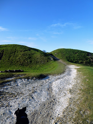
Initially on a continuation of the road, then on a flint based track with a steady incline The path divided here a little... a direct route through some chalk quarries, and a less strenuous one following the vehicle track. We would come down the direct route, but continued up the steady gradient.The sun was now out, giving us views across to the west and towards Amberly.
Looking East the ring came into view as a knot of trees on the ridgeline. As we came up onto the ridge line we met a reinforced wind, but also views to the North across the Weald.The Ring had a main entrance at the top and lead into the copse of beech trees .. sentinels in the winter, but would be more daunting once covered in leaves.Just to get the complete picture we crossed over to the high points on both sides of the ring the eastern one being marked by an unpicturesque bowser tank.Another large black cloud had now settled above us and as we descended through the chalk pits it started raining once more.. apart from making the grass and chalk pebble slippery it was not heavy enough to get a full soaking however grateful to be back at the van.From here we followed the road South to find another car park close to Cissbury ring. .. there are several, however we managed to find a convenient place next to the recreation ground on the road hat heads up to some unmarked parking just under the ring. This would be a good point to stop for a walk linking the two rings, in future.
The road led up at another constant gradient, almost deja-vu from this morning, except this was metalled.Once up at the pasture level we could see the outline of the hill fort rising above the fields - much bigger than Chanctonbury.
At the top of the ridge leading from the hill fort was an unofficial parking spot - to be remembered for future walks, and the main track lead off on a diagonal run across the ramparts up to the high point where the original entrance way still stood.
Following the chalk path through the gate and up the inner rampart to the left and then off around the boundary ... showing great views down to Worthing and the sea with the sun reflecting off the rain puddles.The complete picture as the sun broke through again.
Around the ramparts - slightly slippy in places but not deep mud due to the chalk. then to the south gateway and the path down to the main carpark, and off up the other side.looking south east to the second carpark and Findon town. As well as over towards Amberly and the continuation of the South Downs way
We slipped off the ramparts and cut back across the centre of the hill fort, but only after some views of the Chanctonbury fort in the distance - the tress make it so distinctive.
the highest point inside was marked with a trig point.
Back down the access track to the car parking and then the road. the sun now shining properly, until we get to the van and it started raining once more ... as if a summary of the day.Two shorter walks both of almost identical length and time.


