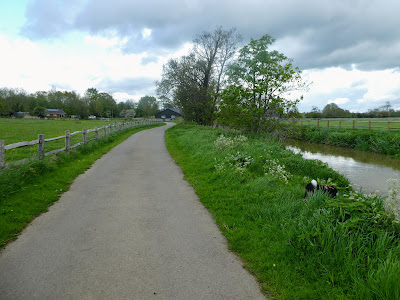
Last week was otherwise engaged with house moves and the weather - lots of wind and rain. After a week of doing other things it was time to get another walk completed. I combined this particular week with a visit to Uckfield. Dropping Sue off with at her mother's house and headed just south to the parking at Barcombe Mills reservoir and wetlands area.


Luckily I ended up on an alternative that proved much easier and less muddy
than the initial plan. Follow the road/ drive through the fields.
 This road took a curving direction through the meadows before meeting the
river complex again at a small collection of houses. In one of the fields near
the first of these was some odd sculptures.
This road took a curving direction through the meadows before meeting the
river complex again at a small collection of houses. In one of the fields near
the first of these was some odd sculptures.


Meanwhile Bertie had gone to the stream for a drink and a paddle. He got a bit of a shock when he slipped in and it was deeper than he thought. soon out but now soaked and even after two big shakes went padding wet steps up the track.

 We would come back to this collection of houses on our return, but for now we
cut around the back of the far left house and joined up with the disused
railway line (that joined up with the Lavender line above where we were). At a
road we left the old track bed and turned left down the road. The remains of
the track still embedded in the tarmac
We would come back to this collection of houses on our return, but for now we
cut around the back of the far left house and joined up with the disused
railway line (that joined up with the Lavender line above where we were). At a
road we left the old track bed and turned left down the road. The remains of
the track still embedded in the tarmac
 Just a short section on the road before continuing north across the fields.
The bridleway here (marked as Blunt's Lane) was very wide, but still
needed care with some huge puddles.
Just a short section on the road before continuing north across the fields.
The bridleway here (marked as Blunt's Lane) was very wide, but still
needed care with some huge puddles.


On the gateposts were signs indicating that the path was blocked as they were
replacing the "over bridge", however this was not marked on the map and so I
decided to continue and work out what to do when I found it.

 Hidden amongst the hedges was the first of a number of Pillboxes we would see
today.
Hidden amongst the hedges was the first of a number of Pillboxes we would see
today.

 The track lead into an area which was tree lined, eventually coming out on the
edge of a field with a foot bridge under construction ... so this was Over
Bridge .... unfortunately there was no way across now as the deck was
still being built, and the stream too deep to ford.
The track lead into an area which was tree lined, eventually coming out on the
edge of a field with a foot bridge under construction ... so this was Over
Bridge .... unfortunately there was no way across now as the deck was
still being built, and the stream too deep to ford.


A quick look at the map showed that we needed too make a long detour to the
west then circle back to meet the river Ouse and back down to meet the
original planned route. adding around 2-3 kms to the trip.


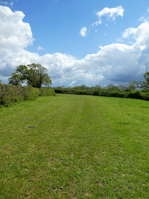
Generally in the fields cutting across the bends in the river.
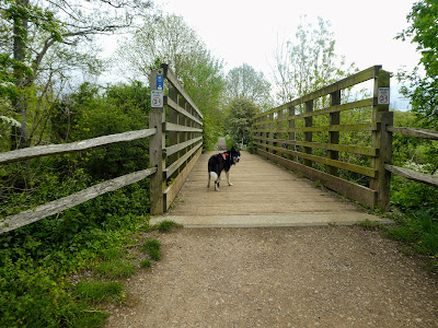
 We met up with the original planned route at White Bridge, where the track
crossed the river to the east bank.
We met up with the original planned route at White Bridge, where the track
crossed the river to the east bank.

 Opposite the Over bridge I could see the work going on that had determined the
diversion.
Opposite the Over bridge I could see the work going on that had determined the
diversion.

 The fields around here had swages of buttercups with slight lines through from
the track and vehicles. The south downs in the distance.
The fields around here had swages of buttercups with slight lines through from
the track and vehicles. The south downs in the distance.


Each field had odd containers in it, I did wonder if it had been (or was about
to be used) for an event of some kind.

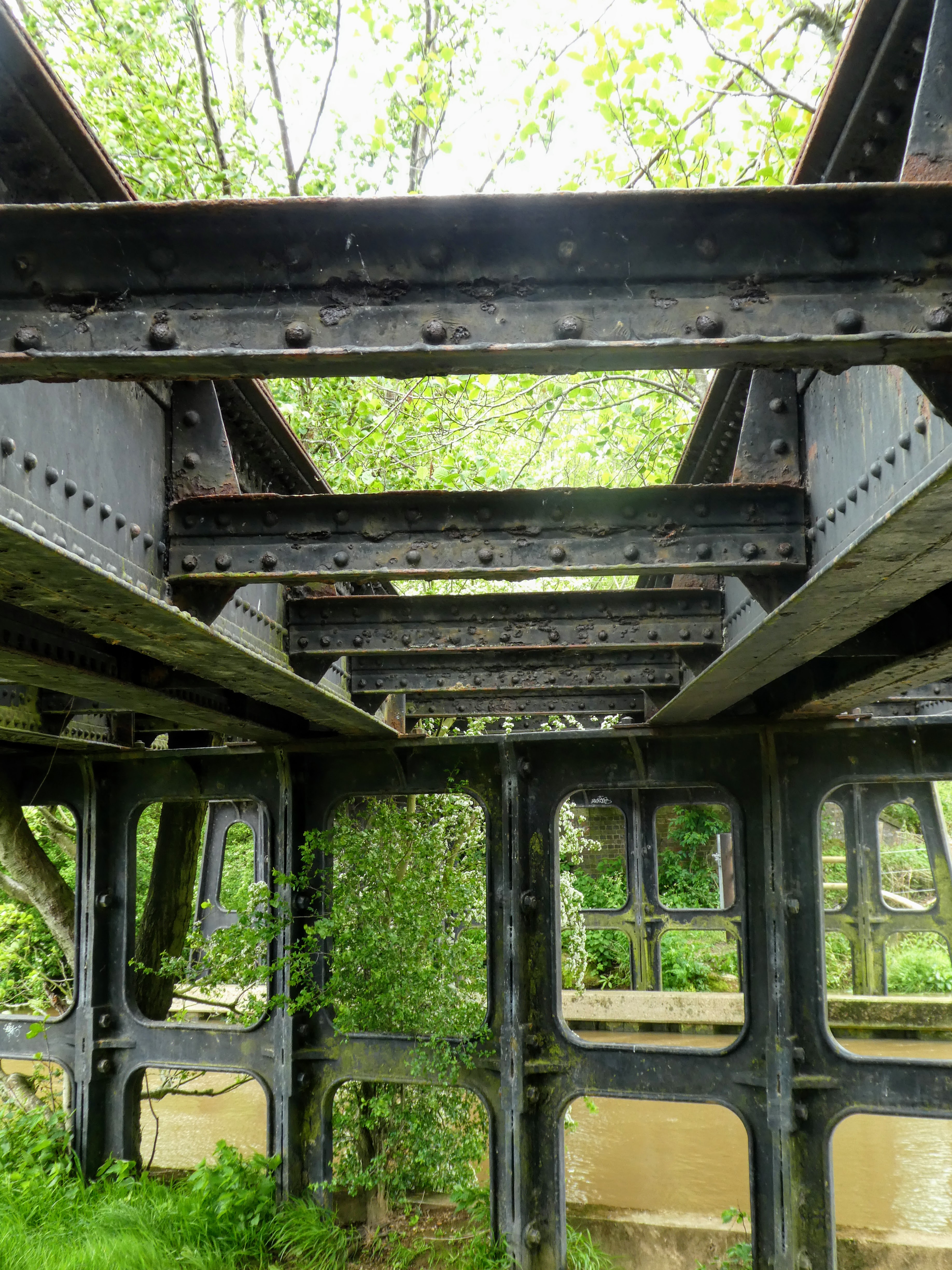
 The track and the river cut under the disused railway line before some more
pasture fields leading to the Anchor Inn.
The track and the river cut under the disused railway line before some more
pasture fields leading to the Anchor Inn.

This last field had a collection of young calves and a couple of mothers. I
passed with trepidation keeping Bertie down the river bank, but the calves
were not interested.


 The Inn nestled at the end of a track, beside the river. On the river a
flotilla of punt/ canoes.
The Inn nestled at the end of a track, beside the river. On the river a
flotilla of punt/ canoes.


We crossed over again at the inn, before cutting through the car park

 Downstream of the Inn was a weir and sluice complex controlling the river
flow. I tried to get some photos of the water coming out but the trees got in
the way.
Downstream of the Inn was a weir and sluice complex controlling the river
flow. I tried to get some photos of the water coming out but the trees got in
the way.

 Through another field, this one was being mowed presumably for silage, and we
kept out of the way. This field ended as we reached the house collection we
had gone through on the way out, this time passing a second pill box in one of
the gardens.
Through another field, this one was being mowed presumably for silage, and we
kept out of the way. This field ended as we reached the house collection we
had gone through on the way out, this time passing a second pill box in one of
the gardens.


 Just before I left the field completely a helicopter came over very low and
landed in the field very close to the inn ... either on an emergency run or
else popping in for a lunchtime pint!
Just before I left the field completely a helicopter came over very low and
landed in the field very close to the inn ... either on an emergency run or
else popping in for a lunchtime pint!

 Passing the houses the other way allowed me to see another sculpture in the
field from earlier.
Passing the houses the other way allowed me to see another sculpture in the
field from earlier.


Turning onto an bridge over the little tributary here, past the No entry and
private signs, which really targeted people straying from the path, we
continued on a path beside the stream.

 As we approached the reservoir (hidden behind the woods to the left of the
path ahead) we crossed a long footbridge over the Ouse where it joined the
tributary we had been following. Now we had a shaded river side walk, without
a sight of the reservoir.
As we approached the reservoir (hidden behind the woods to the left of the
path ahead) we crossed a long footbridge over the Ouse where it joined the
tributary we had been following. Now we had a shaded river side walk, without
a sight of the reservoir.

 There were "lifesavers" along the river now as we were closer to habitation.


A pause for a refreshment while we were on our own, and then continued on
the final section.


At the end of the reservoir the track moved into an open area of flood plain, in the far end we could see some people moving around - they turned out to be painters - must have been a group outing.
 Last section as we filtered through the tributaries, and past a third pillbox we arrived back at the weir and the track back to the car park.

At the van we had a quick picnic before heading back to Uckfield to meet Sue and her mother.

