After the rain of the last three days at last we had a forecast of sunny spells - Bertie and I set out for another exploration into the Surrey Hills between Dorking and Guildford. We had a route planned startign at Friday street and going through Abinger common to Gomshall then back through the Abinger roughs to Wotton and back to the car park.


We set off through the woods of Abinger Common open access area of Wotton
estates, heading west to pick up the road to the village of Abinger Common
itself


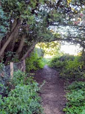
The map showed our desired path coming out the other side of the church
grounds, and only a small sign on the entrance arch showed the way through the
graveyard and out the back via an old iron gate.
 The path went around a mound shown as a Motte on the map but looked too
small to be significant.
The path went around a mound shown as a Motte on the map but looked too
small to be significant.


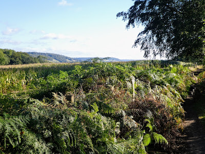
As we came out into the fields the views of the north downs - Netley Heath and
White Downs - opened up

 Continuing through the fields - sweetcorn and turnips - to Raikes farm, with
more views of the downs.
Continuing through the fields - sweetcorn and turnips - to Raikes farm, with
more views of the downs.
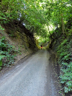
 The path dropped down onto Raikes Lane - a deep cut road - for a very short
section, before ascending out the other side and up to the fields once again.
The path dropped down onto Raikes Lane - a deep cut road - for a very short
section, before ascending out the other side and up to the fields once again.


Wide views of the North Downs on the other side of the valley.


 Still more turnip fields, and then down an old drove lane towards the
outskirts of Gomshall.
Still more turnip fields, and then down an old drove lane towards the
outskirts of Gomshall.

 The track came out onto a tarmacked lane alongside the large ponds of the
Tilling Bourne before it came out onto the A25
The track came out onto a tarmacked lane alongside the large ponds of the
Tilling Bourne before it came out onto the A25

 Coming out by the railway bridge in Gomshall, turning East along the road
until we could pick up the ancient trackway of Beggars lane.
Coming out by the railway bridge in Gomshall, turning East along the road
until we could pick up the ancient trackway of Beggars lane.

 Shortly after turning up the lane we cut off, rising into Piney Copse - NT
owned, but originally owned by EM Forster to prevent housing in the area.
Shortly after turning up the lane we cut off, rising into Piney Copse - NT
owned, but originally owned by EM Forster to prevent housing in the area.

 Coming out the East side of Piney copse and along a path with views up the
North downs, and across Hackhurst lane
Coming out the East side of Piney copse and along a path with views up the
North downs, and across Hackhurst lane

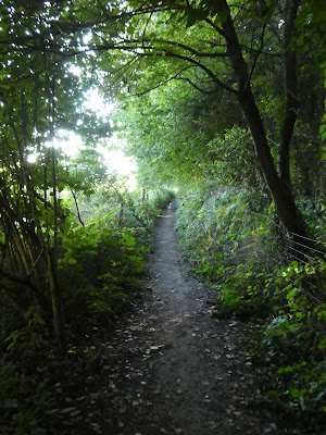
 the lane then leads into the woods as they rise into Abinger rough. This is
National Trust woodland and is crisscrossed with paths, however we followed
the main bridleway through the broad-leafed trees.
the lane then leads into the woods as they rise into Abinger rough. This is
National Trust woodland and is crisscrossed with paths, however we followed
the main bridleway through the broad-leafed trees.

 Passing a memorial to Samuel Wilberforce - son of Wilber.
 Crossing another road the track continued alongside Deerleap woods, with views
along North Downs past Box Hill.
Crossing another road the track continued alongside Deerleap woods, with views
along North Downs past Box Hill.

 Arriving at a lonely house in the bottom of the valley, selecting the path
running south and through the woods - once more hemmed in by fences up and
over Deerleap woods.
Arriving at a lonely house in the bottom of the valley, selecting the path
running south and through the woods - once more hemmed in by fences up and
over Deerleap woods.

 Passing a saxon church, supposedly with carved heads of King John and Stephen
Langton. Thence down the drive way to the village of Wotton.
Passing a saxon church, supposedly with carved heads of King John and Stephen
Langton. Thence down the drive way to the village of Wotton.

 Picking up the path again at the back of the pub carpark in Wotton, lead
through a grazing field - luckily the belted Galloway cows were far enough
away from the path.
Picking up the path again at the back of the pub carpark in Wotton, lead
through a grazing field - luckily the belted Galloway cows were far enough
away from the path.

 Down to cross the Tillign Bourne once more ... the hedge forming a cover
over the path and across the trickle, even after all the recent rain.
Down to cross the Tillign Bourne once more ... the hedge forming a cover
over the path and across the trickle, even after all the recent rain.

 Into Damphurst wood, inevitably climbing and descending before coming out onto
a bridleway running up a valley with ponds and weirs
Into Damphurst wood, inevitably climbing and descending before coming out onto
a bridleway running up a valley with ponds and weirs
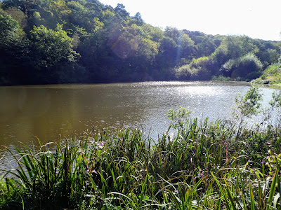
 Coming out at Mill pond, just outside Friday street - we could have cut back
to the car park from here, however as we had made good time and were early,
there was time for a little extension at first East through Severells copse
Coming out at Mill pond, just outside Friday street - we could have cut back
to the car park from here, however as we had made good time and were early,
there was time for a little extension at first East through Severells copse

 Then turning south through the woods besides sheephouse lane

 Now west .. this time in fields of corn stubble, before dropping down to
Abinger Bottom
Now west .. this time in fields of corn stubble, before dropping down to
Abinger Bottom

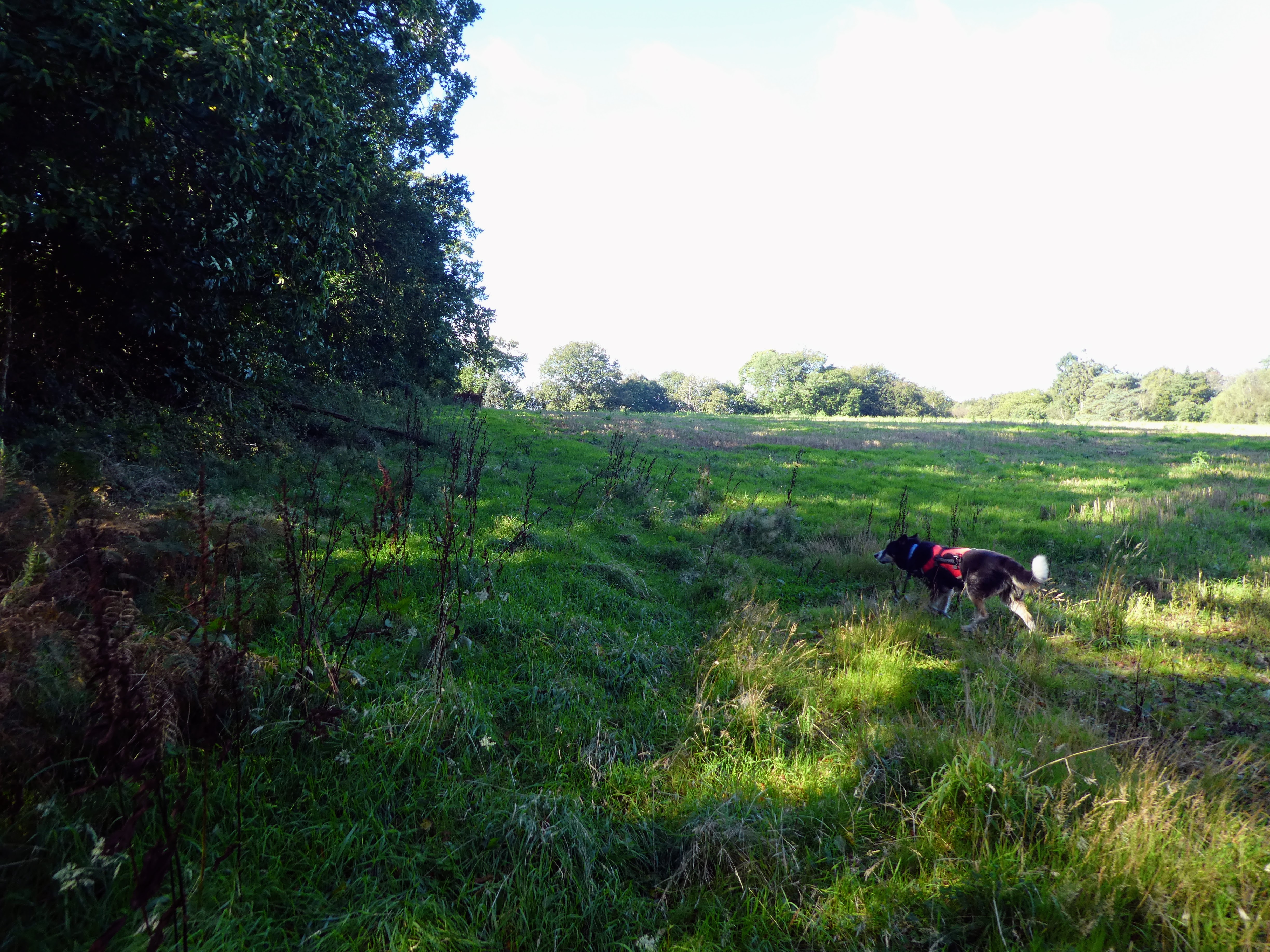
 Back in Abinger common woods and zigzagging north, initially muddy enclosed tracks before it opened out into heathland

 cutting through the bracken to the car park, where there were a few more cars.


A relaxing picnic in the van before returning home

