I decided on another link in the Greensand Way today, it was chilly but
had been dry for a while so I hoped that the mud was somewhat less severe. I
reasoned it was easier to park in the old rectory carpark below Hascombe hill
than try and find somewhere at the Wormley end.
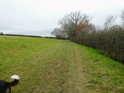
Leaving the van and walking down the large vista towards the White Horse pub,
which was at a junction of many paths, including the GSW as it crossed the B2130
road.
Leaving the pub car park, we cut over a field on a sandy track. Before turning
right at a path crossroads (we would come back here later) and the first mud of
the day - avoidable.
the path came out onto a minor road and then rose up the other side after a
slight stagger, and through the pasture behind the house to the woods.
Through the copse above the pasture, on a wide lane, before crossing a minor
road (Mare Lane) and up a private road on the other side. This was marked on the
map as a bridleway, however there was a locked road and foot gate across it. I
asked a local dog walker on the other side who confirmed it was a public path
and pointed to a bridleway sign on the other side of the gate. So we vaulted the
gate (or rather Bertie was hauled over), and I climbed it.
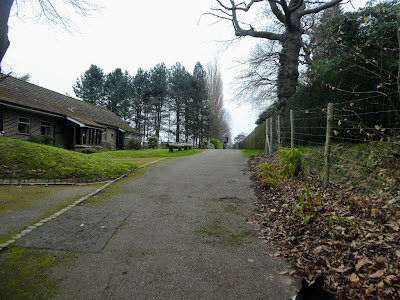
This private road went past a number o f multimillion pound house estates, and
then joined up with the road I had been on form my walk to Guildford. Where this
road merged onto the B2130 we turned back on ourselves and took a bridleway down
the back of the houses.
The path gently climbed into a wood, before dropping down into a valley.
a multiple level junction at the bottom, before rising up the other side and
then following a forestry track as it climbed up a small defile.
Across the road (Salt Lane) and into Hydon's Ball car park. As is usual around
here there were a large number f paths in all directions and I had to check the
route several times, however sticking the largest direct track worked.
On a whim to go to the top we took a direct path, that climbed to the highest
point.
On the top there was a wide open area, surrounded by reservoir access points -
the whole top musty be covering the water.
Looking South, however we cut East first
Dropping down through the bracken and gorse we passed another monument to early
donors to the National Trust. Following this we dropped down through more open
woods, pickup again on the wide track we had started at the car park.
The track opening into crop fields crossing diagonally to the church spire -
hidden in the trees
Coming out at the church and Court Farm we passed this old lime kiln. We woudl
be back here shortly, but this time we soon picked up a path leading away from
the road.
The path came out at another pub - The Merry Harriers, with some glamping and
Llama walks.
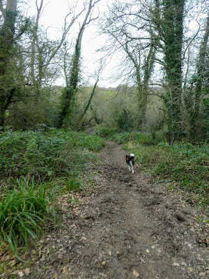
Now was the muddiest section of the walk ... along a river pasture,
luckily it was not too deep and I got away without too many issues. Finally the
track had a number of railway sleepers laid to assist, and even provide a raised
walkway to the side.
Entering into Buss's Common we turned off the main track onto a footpath
crossing the short side, however Bertie did find a suitable pond for a dip.
This path then led into a pine forest, with bracken undergrowth. Here was much
drier.
The track came out at an unmarked carpark beside Sweetwater pond. We tracked
around the end of the lake on a road and then re-entered the forest, climbing
slightly up to and then beside the main railway line from Guildford.
Crossing over the A283 main road and then down a minor road and past the
entrance to Wormley station (where we had been on the walk from Haslemere).
Opposite the station entrance road we took a path behind a row of houses, that
came back to the A283, where we crossed over and picked up a back road.
Where the road turned sharply we continued on a dirt track, curving into
Hambledon Common
Once on the common we angled away from the GSW across the common to come out
on a road leading around the southern side of the village.
Past the village shop and PO, the other side of a pond, with picnic tables,
and around the cricket pitch. The white house on the righthand side is
Oakhurst Cottage, an old NT house.
A bit of path sidestep follows as we did a series of Knight's moves to reach a
track cutting through pasture fields with the spire of St Peter's church on
the horizon
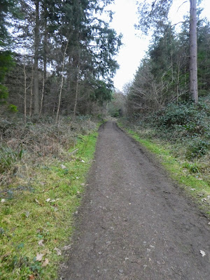
A final steep slope up to the church and to touch our outward track. From this
junction of paths we took the wide dirt road heading east, with the woods of
Hydon heath to the left.
The lane got a bit narrower, as we passed a reservoir, still in a straight
line, up to Vann Hill
From Vann Hill we followed a bridleway into the woods, as it contoured around
about halfway up a slope. After a while the view opened up to the south,
unfortunately this was rather misty.
The track crossed Markwick Lane with a slight zigzag, and a bypass where the
original path was blocked with fallen trees, then up into The Hurtwood.
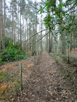
The older part of Hurtwood was wide and open. We were on a straight line
track.
This changed into an area that had been harvested , and replanted, the right
slightly older than the left.
A steep exit from Hurtwood, and back to the fields opposite the White horse. At the junction of tracks we had been at earlier we used the path we had not yet taken.
We went up the road for a few meters before we could break through the hedge and onto the wide vista and so back to the car park. Once in the van for coffee and snacks before returning home.