Working around the weather, today was forecast to be the last clear day before a
period of cloud and potential rain. Bertie and I headed off to Iping Common near
Midhurst to complete another section of the Serpent Trail - as well as a couple
of routes out of the OS book that used the trail. In a mash up of the two I had
worked out a figure of eight starting at the centre base, before joining where
we had reached on the last walk in this area, then working back to Midhurst.
Leaving the van in the main car park, we started into the mist following the ST
signs ... it was immediately apparent that this was an area that had been
re-routed as we veered away from the mapped route.
Still following the ST signs we dropped down off the plateau of Iping common
following a track to Elstead road.
Upon reaching the road we reached the edge of my map as well as loosing the ST
signs ( I think it turned off somewhere along the last track but to avoid
confusion we returned to Iping common and climbed back up past a motorbike
scrambling zone heading to the mapped route. The mist dissolved and the sun came
out.
Back on the original track we dropped once more to a back road which we followed
to the hamlet of Dumpford.
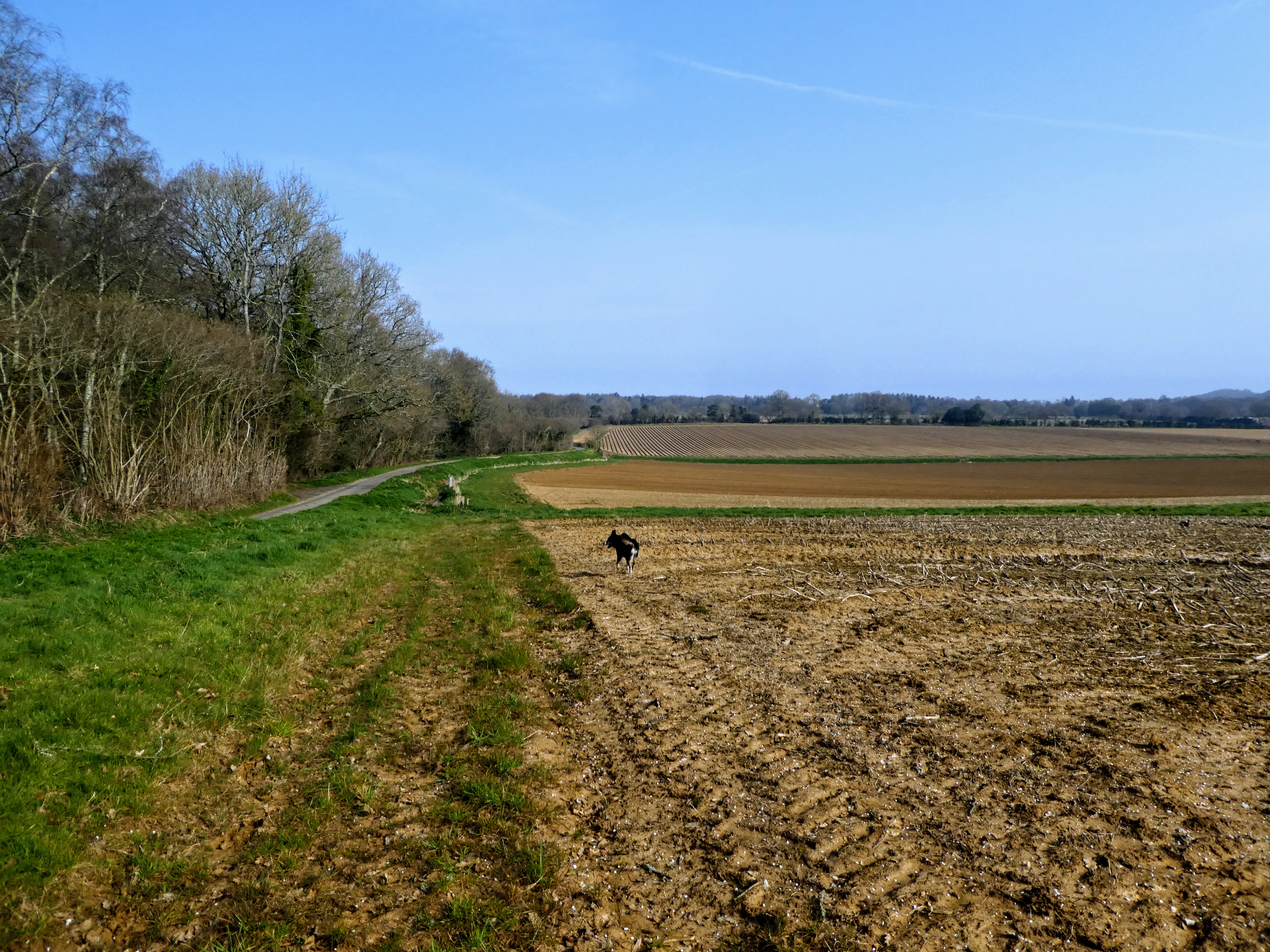
Turning down a lane to cross the river Rother for the first time today we passed
Terwick Mill. Crossing a field to gain the access road we followed it up to the
A272 near Trotton.
The map showed a path in the field beside the road, however there was a thick
hedge in the way and we had to fight the traffic up to a junction, where we
could escape into the field.
Heading on an indistinct path between the lane and a series of ploughed fields
to the woods on the skyline. Here we turned onto a byway along the top of the
fields.
this track passed to the north of Chithurst Buddhist monastery behind the
hedge.
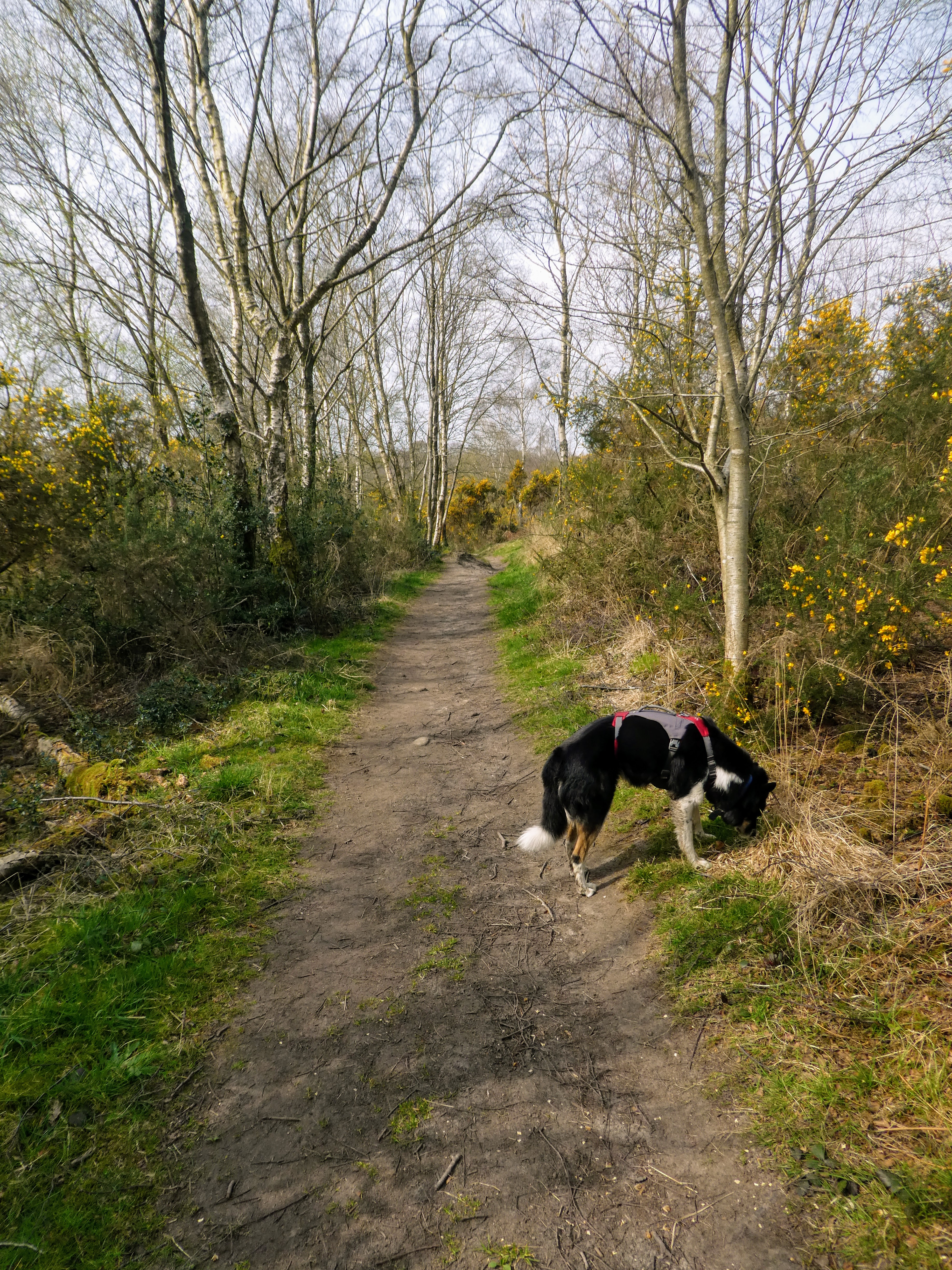
A narrow back road then lead down to Hammer pond, where we followed a trail into
the woods
The trail undulated as it climbed above the river - unfortunately marred by the
plethora of private signs.
Every so often the views opened up showing where we would cross back East.
However first some more climbing up to and across a road.
Picking up a Green lane, before thongs went wrong. I mistakenly took a side road
leading to fields now going south instead of West.
Compounding the issue it was a while before I realised and then there was a
further diversion along a back road to get back to where we should have been -
two and a half kilometre diversion!
Back on the ST at Borden, where we had left it. Here it cut down into some woods
which were being harvested, dropping down to Borden Lane.
Continuing up a driveway opposite the T-junction we continued with a small
diversion into the hammer Stream (the same as fed the pond we passed
earlier).
Into Kingsham Wood, when the drive ended on a pleasant trail lined with
Primroses.
The next section contoured around Dunner Hill in some soggy pasture fields,
before a zigzag of quagmire around some houses.
Entering into Steadham marsh - damp but not too muddy, just some wetter areas to
navigate. Some of the ST signs were a little ambiguous here and we missed one,
but no big impact on the route.
Crossing into Woolbeding common came with a sharp climb before traversing around
some houses.
another sharp climb took us directly up the slope to the trig point on the
ridge.
Opening out with views across to where we had come from, and a seat with a view
for lunch.
Leaving the viewpoint and car park we crossed to the edge of the common and
followed a wide track down to an unmarked car park above the Edward VII
estate
Leaving this car park and taking a track labelled Lipchis way on a gentle
descent through wooded moorland. Coming out at another car park (empty) on Linch
road.
Continuing to descend we reached Woolhouse farm with a collection of old wagons.
Following the track around the head of a number of springs, and down the
resulting stream.
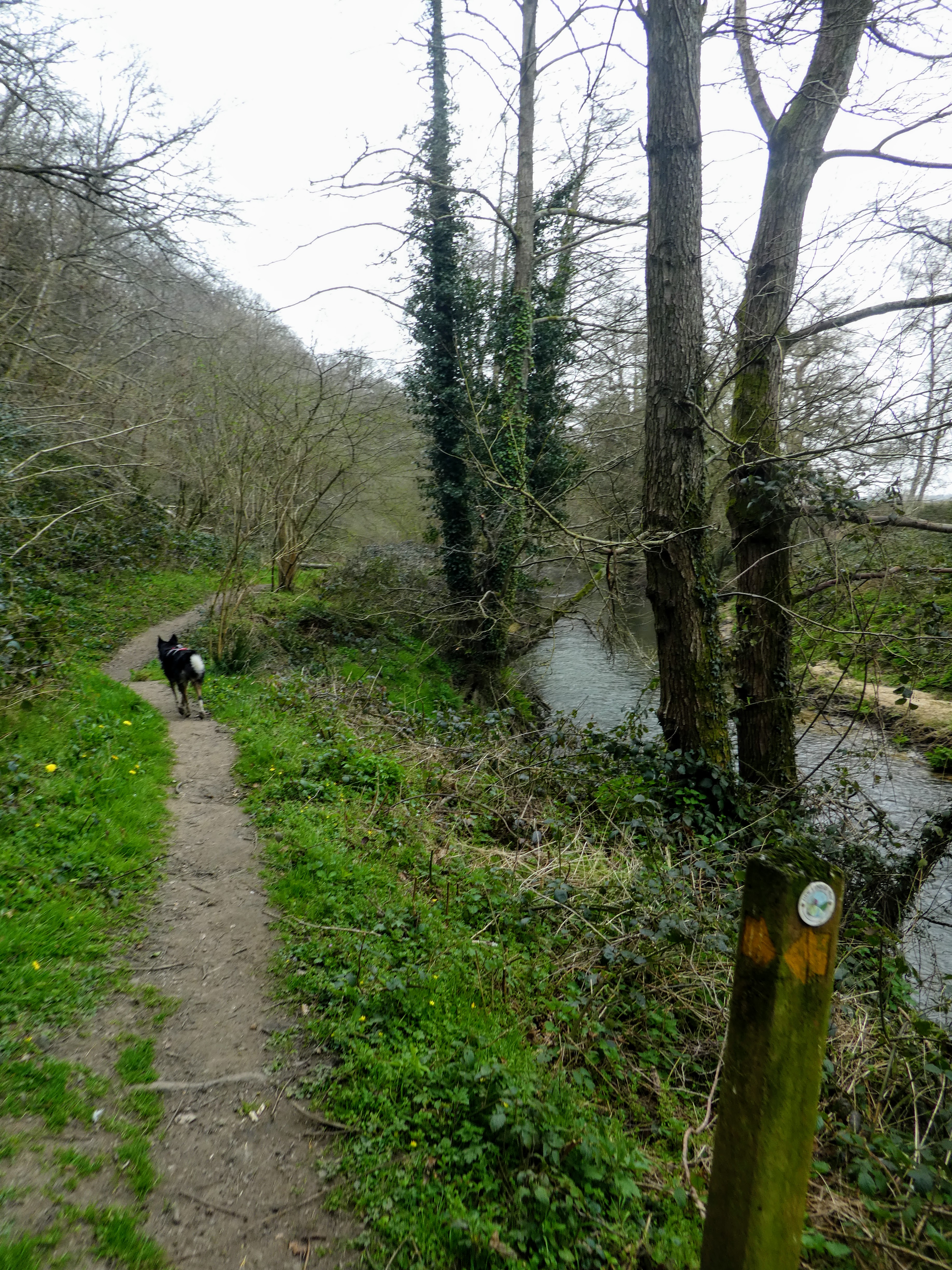
Above Ash house, we dropped down to the stream picking up the path beside it.
Back down on the plain and the pasture fields approaching the Rother river at
Iping
Cutting the oxbow bend under Rotherhill house, then back to the river side
path.
Stedham bridge to continue on the river trail, bypassing Stedham hall
Going aroudn the next big oxbow past Stedham Mill. Continuing around through the
open access area.
The trail opened into a huge field (local dog walking from Midhurst) that cut
the corner to Woolbeding bridge - the last one for this trip.
A final dip in the river before climbing up to the A272 on the edge of
Midhurst.
Across the main road and down Sandy Lane leading into, the beginning to be
harvested, Severals. Here we picked up ST once more which we would follow back
to the van.
A zigzag over a back road and still in the same direction
Dropping down to cross a stream at Woolmer bridge around a cattle farm, and up
the other side into Stedham common.
Across Minsted road and back into the woods.
The woods gave way to more sandy heathland similar to what we had started with as we came back to the van. A police notice on the windscreen showed that this was a theft hot point and I should be aware. Next time I will park elsewhere. This had been a long walk particularly due to the diversions caused by my map reading, however there were some really nice elements - especially up on woolbeding common - 200m high.