30 March 2023

Axams Lizum

Our last day in the Pillberg apartment, this time there was no wish to extend - the weather was due to turn even more variable and no real sign of freezing without going high. It started raining as we emptied the apartment and loaded up the van. So in a final fling the aim was to take in another of the Innsbruck local ski resorts that had organised tour routes - this time Axams Lizum - and then head back towards the channel. As a last act in the apartment we booked a room in the Ibis Budget hotel in Strasbourg for the evening.
We selected the "blue" or "ladies route" up to the top station of Hoadlhaus, subconsciously believing that the red route would be steep and hard packed.

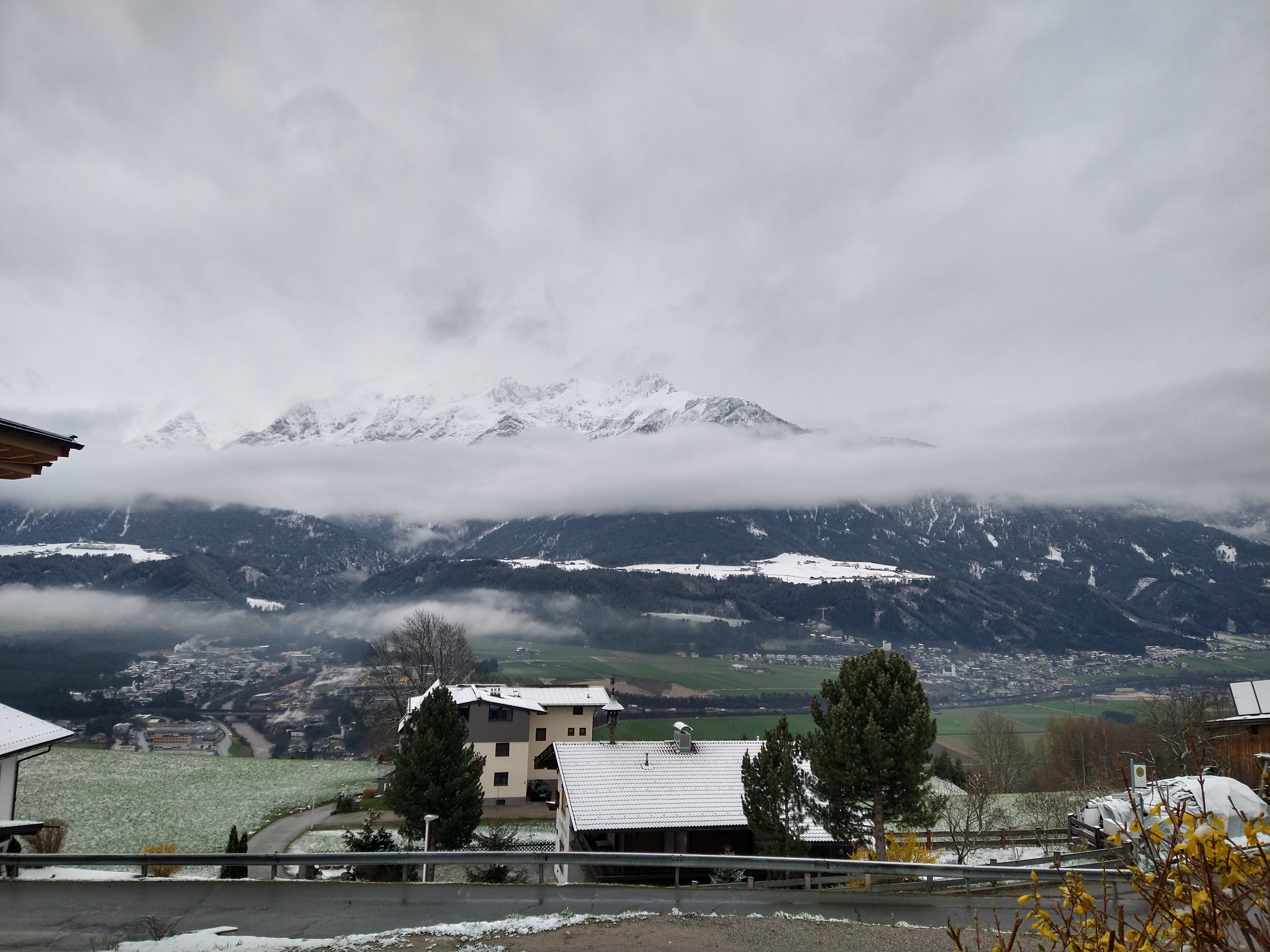
The parking area at Axams Lizum was sparsely filled with vehicles, and we got the gear ready and walked over to the end of the blue piste. Above the peaks looked impassable, but we knew there were tours around that we could recce whilst on the tour. We payed the "inevitable" 6 Euro for the days parking and made sure we used the facilities.
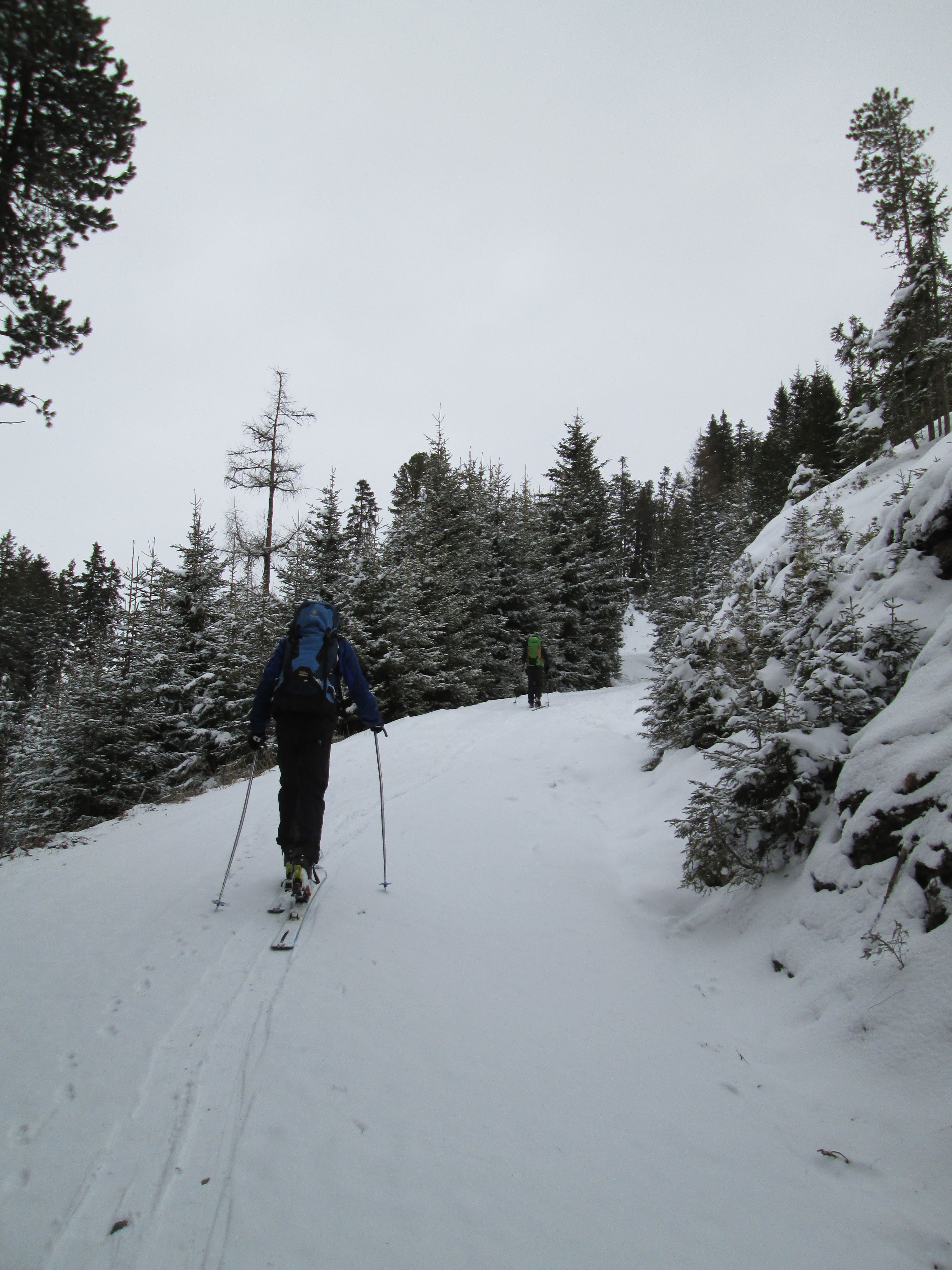
Skis on and we started dup the piste, only to be blocked at the ski bridge where tourers are not allowed to cross and we had to walk around - note that later on we saw several parties ignore the exclusion and just continue.
We started off curving away from the ridge that the lifts followed.
The trail curved around the head of a little valley, and around to some trees.
From the apex of the turn we cut up into the trees, and away from the piste. It occurred to me that it would make sense for this resort to do something like Areches and make more of this by separating the uphill from downhill more.
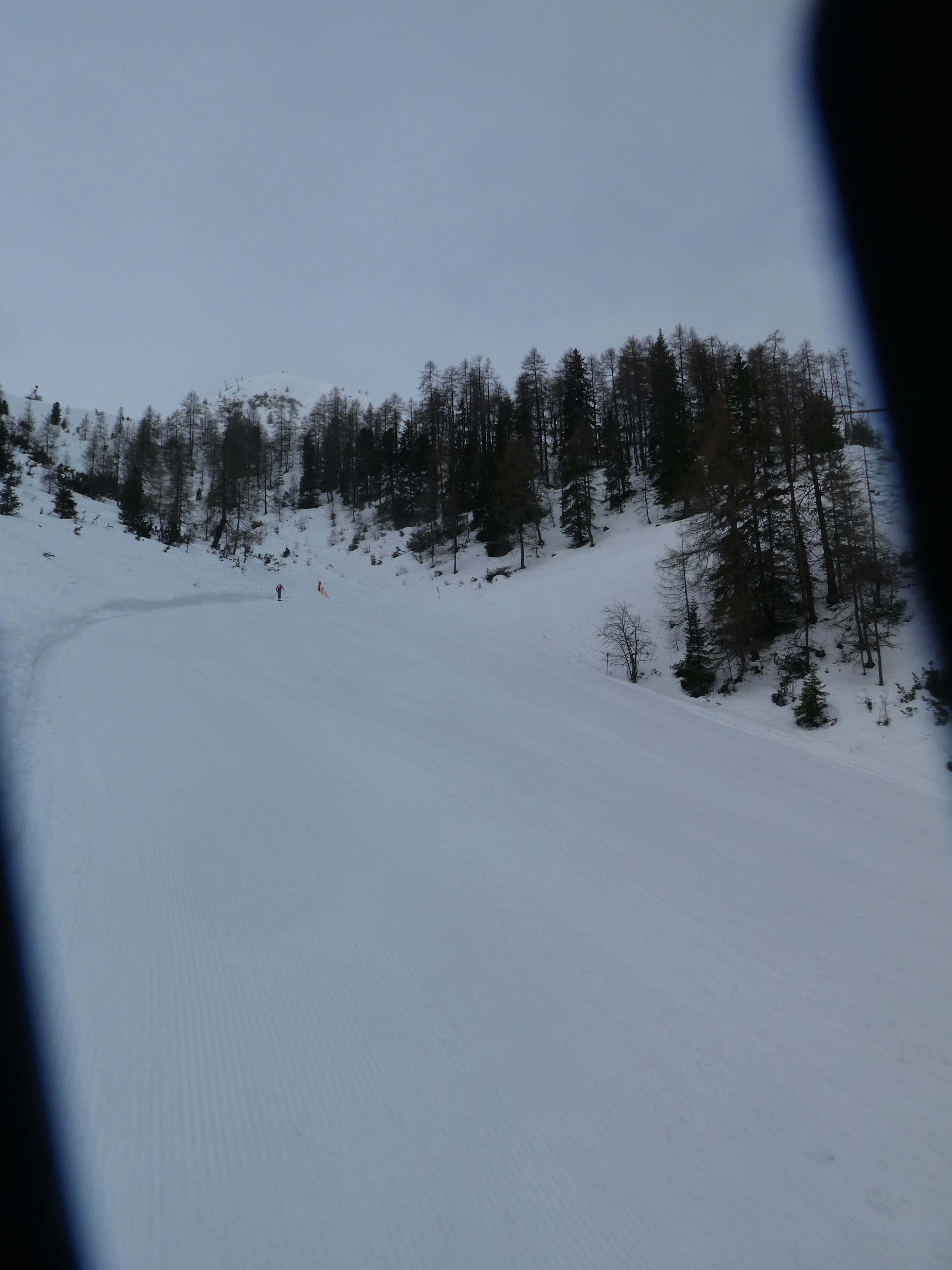
Leaving the trees and climbing up the piste again. the pistes were empty, however what traffic there was was very young - maybe an early Easter break?
We reached a snack bar - Dohlennest - pumping out classic rock. However it had a good view over the Herzlteich reservoir where I had assumed the other tours left (however looking at the map later on I had missed that they left lower down - before the tree diversion). It also gave us our first good look at the top station.
Continuing up the piste heading for the slight col - Hoadlsattel. The route zigzagged up the slope rather than take it directly.

On the saddle looking over into the valley with the Kemater Alm routes.
Now we followed the route up to the summit buildings.
The final slope looked steeper than it actually felt like, and we arrived back into the bustle of the lift areas.
The summit had a huge cross as well as the plethora of buildings, as well as the crowds. At the top the sun started to come through the clouds. In was more apparent here that the majority of people on the slopes were school trips some accompanied others not.
Looking West towards Sellrain and Kuhtai
After lunch in the shadow of the buildings we got ready for the descent. This time we chose to descend the red route - to check if it really was steep. The initial slope was all we expected.
The steep slopes continued around to the Middle station of the Hoadlbahn, after which it eased, however this was also the point where the snow degraded to the heavy sugar debris.
The final stage down to the car park and the van got very soft and slushy. The route dropped down around the lift station and finished where we had started.
The final act was to dry as much of the slush off the equipment as we could in the sun that was now all pervasive. We changed out of the ski clothes and into traveller options, then re packed everything into the van ready for the return journey.
An extra visit to the facilities (to make the most of our parking fee) and we set off for our return.

29 March 2023

Largoz, Volders

Mixed forecast for the day, and we woke to clouds in the valley below and above. With the recent snow there was a hope that it would have made less walk-ins on some of the routes, so we decided to have a look at one of the local favourites - Largoz ...   the point on the end of the next ridge east of the one with Glungezer on it.
We drove down the valley to Villers and followed some back roads up to the Krepperhutte, and parked in the car park just after it.
The route went up a forest road that zigzagged slightly up to Largozalm, after which it climbed through meadows up to the ridge and summit.
From the car park we went past the barrier and continued up the road (there is a footpath through the trees in a more direct line, but as we find out later this was not worth it at this stage. we continued up the road passing the alternative road reserved for Rodelbahn traffic. The sky was still overcast, with occasional snow flurries, which may even have come from the trees.
After a turn that went back down the valley we took the next turn with the idea to meet the forest track a little higher and with a bit more snow on it.
This track contours and climbed back above our initial direction and we soon met the footpath.
We turned off onto the footpath and climbed through the forest - it was barely covered and very slippy on the tree routes.
With hindsight we should have stuck to the roads with the constant gradient and coverage of snow.
The footpath cross the road again above us and we took the opportunity to avoid the footpath continuation and settle for the road. This soon turned back on itself and climbed up back again in the original direction.
Once more it turned back on itself and continued on the road until we could see the buildings of Largozalm above us.
Below the alm was an open slope with several traces to pick from and we climbed up to the buildings.
Beyond the buildings we climbed up the righthand side of a bowl, on the ridge edge bordered by a number of trees (probably safer in case of avalanches). By now we were getting some strong wind gusts and more layers were required.
At the top of the bowl we angled back towards the top (shrouded in the cloud) climbing through several bowls. 
We reached a slight gully on the west side of the summit that traversed to the north ridge. Above we could see a large rock outcrop on the summit.
The tracks we were following (the only other person to have been up here today) stopped at a point in the gulley where he had turned around and gone down. Maybe we should have followed his choice as the higher we got the more impact from the wind both on us and the snow, which was now getting very hard packed, however the cross on the summit was a siren call to all.
The final climb up to the summit block along the north ridge, was extremely icy and very hard packed, however it was a relief to get some shelter behind a rock.
We removed the skis for the final few meters up to the cross. Bryon doing a sterling effort to cut steps for the rest of us made a simple task to get up to the huge structure on the summit.
Summit photos taken we retreated the ski lager and readied for the descent - a bit of debate over the best way to get down the top icy section and we were soon scooting into the gully and a respite from the wind.
From here we followed the trail of the early guy and dropped more directly down towards the alm.
A series of knights moves, through some fantastic powder meadows separated by lines of trees going up the slope.
Back at the alm and some real respite from the wind, we stopped for a snack, before continuing down to the forest road.
The return was completely down the forest road, however this was not as simple as it was first thought.. in a couple of places higher up, the snow got very thin and should have served as a warning. However just after the top hairpin I skied over some lightly hidden gravel and ended up lying on the ground.
We walked down to the next more suitable snowy bit and continued, although more slowly and with a greater look out for hidden traps. Several sections caused scratched to the ski bases but did not stop me (although Steph had a near repetition when she got caught up). finally close to the bottom we gave up and walked back to the van. The skis suffered for this descent and will need some TLC once we are home.