Constant high Pressure has led to more warm sunny days, although the wind is
getting stronger. I had planned a route to the south of Devil's dyke heading
down towards Portslade then curving back up and around to retouch near
Patcham. Returning up to the Dyke via the Saddlecombe farm.
We parked in the summer down car park, overlooking the dyke, and followed the
road up - we avoided the main path due to the two very "energetic" dogs running
free. The other side of the road was scrub, but with several paths running
through it.
Touching the road once more we turned down the track crossing the Dyke golf
course, with views over to the sea beyond.
When we arrived at Devil's Dyke road we turned up the track along the edge of
the golf course back up towards the end of the dyke - we had followed this extra
loop to get away from the crowds going towards the Devil's dyke pub and
lookout.
We turned down the green track down a tongue of land sticking out between the
fields. Protected from the cattle by fences on both sides.
At a crossroads of paths we turned down to the farm track towards New Barn farm,
then up the concrete road on the other side. Over the A27 on a bridge before
following a path beside Foredown road.
In the residential area we followed a road down to a roundabout then up the
other side - in an overgrown green space.
The green space opened into Benfield Valley golf course - which cannot have been
a full one but rather a few holes only. Then back over the A27 on a foot
bridge.
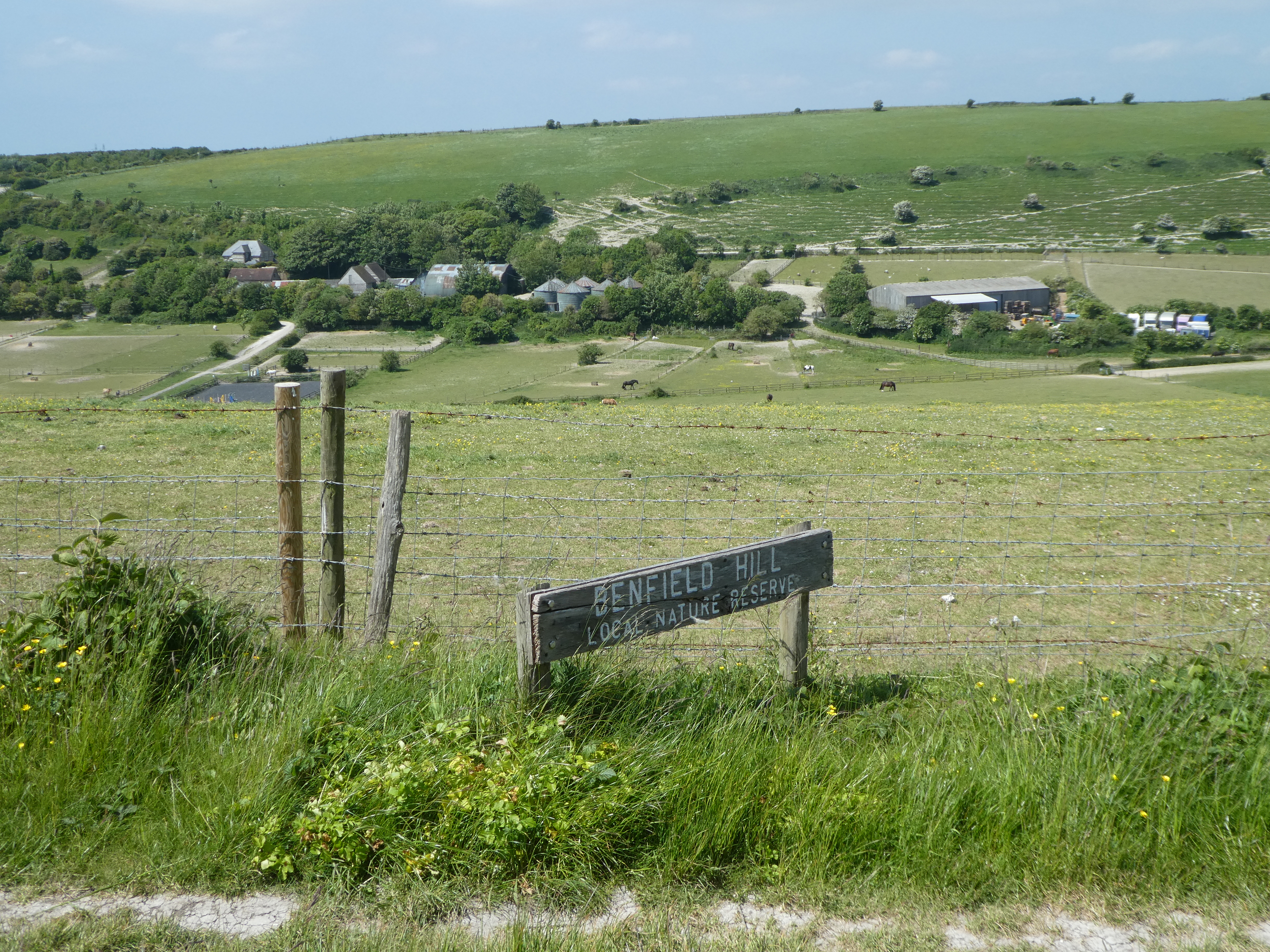
On the north side of the road we avoided West Hove Golf Club by climbing
Benfield Hill.
Over the top of the hill and back to the crossroads to take the fourth track
heading east. This dropped down around the end of the golf course.
Now on the Monarch's Way we crossed the bottom of the valley and up the other
side
Across a track (a Dismantled Railway base) and alongside the club house for yet
another golf course - Brighton & Hove - proudly advertising as the oldest in
Sussex! Along the driveway up to Devil's Dyke road
Across the road and through a couple of fields following the map, but I suspect
a better path would have come from the nearest car park. Across teh Saddlescombe
road and down the drive way to what is now a nature reserve and education block
- on the map it is shown as Waterhall golf course!
Beyond the nature reserve we dropped once more down towards the A27 ... looking
over to the windmill on Coney Hill
The path came out at the club house for the playing fields, before walking along
the playing fields.
At the far end of the playing fields we crossed and started climbing up
Winterhall hill - another nature reserve. However we had to drop down a little
to pick up the bridleway heading over Sweet Hill, and climbing once more.
Up on the rib we merged onto a chalk track heading straight to teh skyline.
We left the chalk track when it curved away, continuing along the side of the
slope until we met the SDW. We followed it down the slope to Saddlescombe.
Past Saddlescombe farm and the donkey wheel. Across the road at teh bottom and
up the other side (still on the SDW).
Climbing up the side of the dyke, until the SDW passed the car park
Back to the van for lunch and Bertie downed a litre of water - most of the sources we had passed were behind fences in cow fields.