After more rain yesterday a new front and today was sunny, so I looked for a route that would not be too muddy. There was a walk from the end of the A3 around Langstone harbour, and down the side of Portsea island to the spit at Southsea. along the base of the island to Portsmouth and up the other side to reach the rail station at the harbour. Hitching a ride on the rails to Brockhamton station and back to the car park.
Bertie and I drove down and negotiated the junctions at the end of the A3 where it joins the A27 to reach the car parks off Harts farm way. The first car park (Chalkdock Lake car park) could only be reached on the return, however the second (Broadmarsh coastal park car park) was 100m down the road. We reached the entrance to find a barrier at 2m so used it to turn around and go back to the first - this was also barriered. So a new Plan B required, and back down the road to Havant and on towards Hayling Island - there was a car park at the bridge.
The car park was next to the Ship Inn beside a slipway looking over to Emsworth harbour - the opposite side to where we were going. The sun was out as we left the van shinign up from the south.We crossed the busy A3023 and set off up the route of the old tramway so we could get up to the track around Langstone harbour.
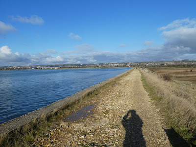
Setting off around the edge of the harbour with views over to Portsmouth and the spinnaker tower. The path here was muddy but not impassable.
The path turned around the spit of South Moor, and back heading west
The path disappeared where the sea had destroyed the sea wall. Luckily the tide was out sufficiently that we could get around it by going inland over the mudflats for a while, then back on the coastal path.
We passed an unmarked car park and on past the sewage works. At the Hermitage stream we followed the path as it looped back around an industrial complex.
A short section along a back road and used its bridge to go over the stream. Then down the other side of the stream and back to the coast. Then eventually around to the second car park and its slipway.
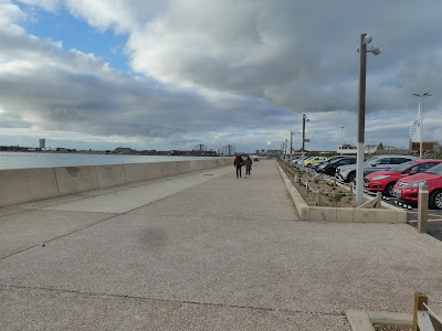
The coast path was now paved as it followed the edge of Broadmarsh coastal path. This section had a lot of people walking their dogs.
Beyond Chalkdock lake car park - the first car park, we continued alongside the harbour on one side with a grassy parkland on the the other side. The path then merged into the cycleway of the Solent way - a tarmacked trail - as parallel to the A27 dual carriageway.
We left the cycleway at the edge of the Farlington Marshes. Here the path turned away from the A27 and we dropped down with views over to Hayling Island.
Looking over North Binness Island and down the side of the spit of land
Down to the end of this spit and now lookign over to Portsea Island and the old forts along the escarpment above the harbours.
Another turn and we were heading back up to the A27 again. Here were a large number of bird watchers. They had been walking down from the car parks access from the A2030 roundabout. This was another barriered place, and was the start point for the bird watchers.
We picked up the footpath beside the A2030 - currently jammed up with traffic trying to get onto Portsea Island. Once over the Broom channel we could finally escape onto the footpath alongside the edge of the harbour.
This foot path continued onto Kendalls Wharf and past a water sports facility. Beyond here the path was being refurbished as part of a sea defences initiative. We had to resort to walking down alongside the road. This continued past a mobile home site, a pub, and a large car park.
At Milton Common, we were finally able to resume the harbour edge path. Onwards we could see the horn of the island.
This section was busy with dog walkers, most of whom had a circuit around the common. we approached the horn as we reached the inlet of Eastney.
The path ended at Milton Locks and conservation area - a sea lock preserved. We tried to continue along the shore, however with the tide being in we could not continue, and had to cut inland beside the Thatched house. We had to work around the inlet by following the roads through the residential areas.
Some small relief as we crossed Bransbury Park and then onto the residential roads .. we tried to get back tot he coast along Ferry road, but this ended in a private housing estate.
Back on Fort Cumberland road alongside one of the marinas
We continued up the road to the end of the horn to a point where we could look over to Hayling Island and the ferry stages. Then we turned around and back along the road until we had got past Fort Cumberland. there was no way we could walk along the shore with the tide being in and we had to get around the fenced off areas.
There was a rough area beside the fort and we used this to cut across and get to the south side of the island.
Out onto Eastney Beach (at the nudist end, although it was too cold today for anyone to making us of it). Now along the beach heading west towards Southsea, walking on the thin line of sand between the shingle and the waves.
We left the shingle behind to make better pace on the esplanade passing the rose garden and model village, and onward to the South parade pier.
The esplanade finished near the pyramid centre where the flood defence work had started again. We were forced to walk along the road up beside the Southsea Common until we were opposite the Southsea Castle.
We could get down to the castle and up to the ramparts beside it and it made a change from the pavement. We cut inside the new works and all came back with the esplanade and the coast path where the works firnished.
Along the esplanade past the war memorial and monuments heading for Clarence pier. We were following the Millennium walk that goes from the Southsea castle up to Gunwharf quays.
Still on the Esplanade passing the Trafalgar monument and through the mass of entertainment and food emporiums then next to a large car park
There was a raised walkway over the spur redoubt away from the kings bastion. Then parallel to the long battery beside the curtain moat and up to the Square tower. the millennium walk here has a trace of slabs on the pavement.
Now on the Portsmouth city walls to the lookout point at the round tower. We climbed up to the top to see the outlook.
Back down we walked around the Point with views across to the Spinnaker tower. back to the round tower and around Camber Quay. Back on the roads around the Wightlink terminal before going around the edge of Gunwharf Quays.
Around the shops to reach the plaza before the millennium walk ended at the Spinnaker tower. From here we navigated the mall to get out the other side and under the railway lines.
Into the railway station and buying a ticket to Havant, we were then pleasantly surprised that a train was due to leave in 5mins. Getting to the train meant going around the end of the platforms and across to the furthest side. Time for snacks and drinks as we chugged out of the island and along the coast to Havant station.
At Havant we crossed over the lines once again and out to pick up the disused Hayling Island tram line this crossed a back road with pseudo level crossing gates that marked the crossing.
We followed the tram way down past housing estates and under a couple of roads (one being the A27) before meeting the A3023. Crossing over and re-joining the tramway at the point where we had left it in the morning. Then back to the car park before the light got too dark.


