The forecast is full of storms, the last one passed over last night and the
next one due tomorrow, so Bertie and I took the opportunity to go out in the
lull between them. I planned a walk along the High Weald Landscape trail
starting where it meets the Sussex Ouse Valley way at Slaugham. We would
follow the trail around Cuckfield (cutting off the Bolney loop) and up to
where it re-met the SOV way near Ardingly reservoir. Then back along the SOV
way via Handcross.
I parked the van at a convenient spot next to the reservoir outside the village
as it seemed more sensible than taking a church parking spot., and then went up
cross lane to pick up a path to get to the village.
The path went down the side of a house and immediately realised I had made the
correct choice of foot ware as we sank into a bog. It was very deep mud and
Bertie was not impressed until we came out of it next to a sheep field.
The path came out at Park road where we turned into the village of Slaugham.
crossing the back road and into the church yard. This was the combined SOV and
HWL trails.
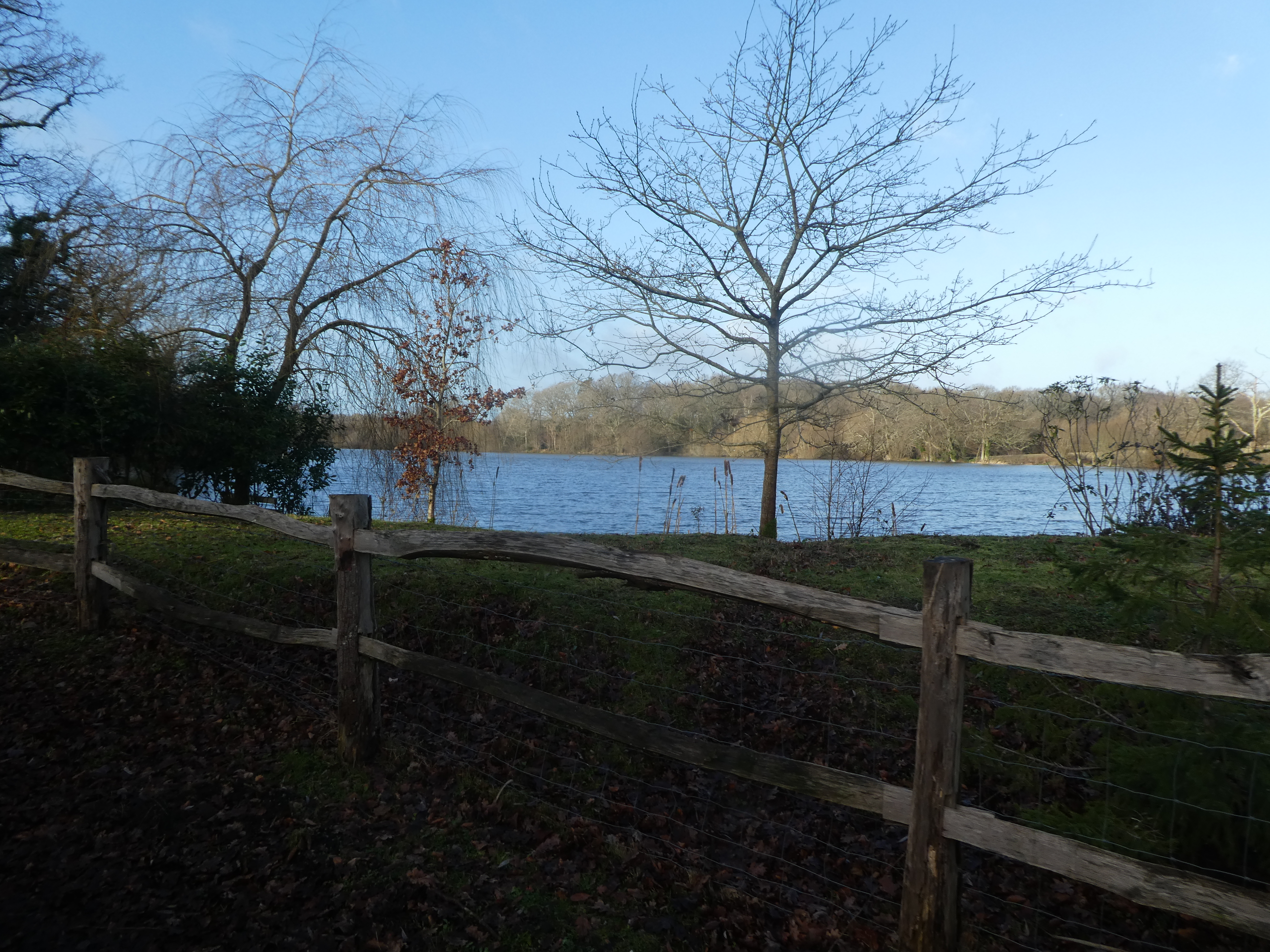
From the back of the churchyard the path dropped down to a large lake below
Slaugham manor, now just the HWL trail.
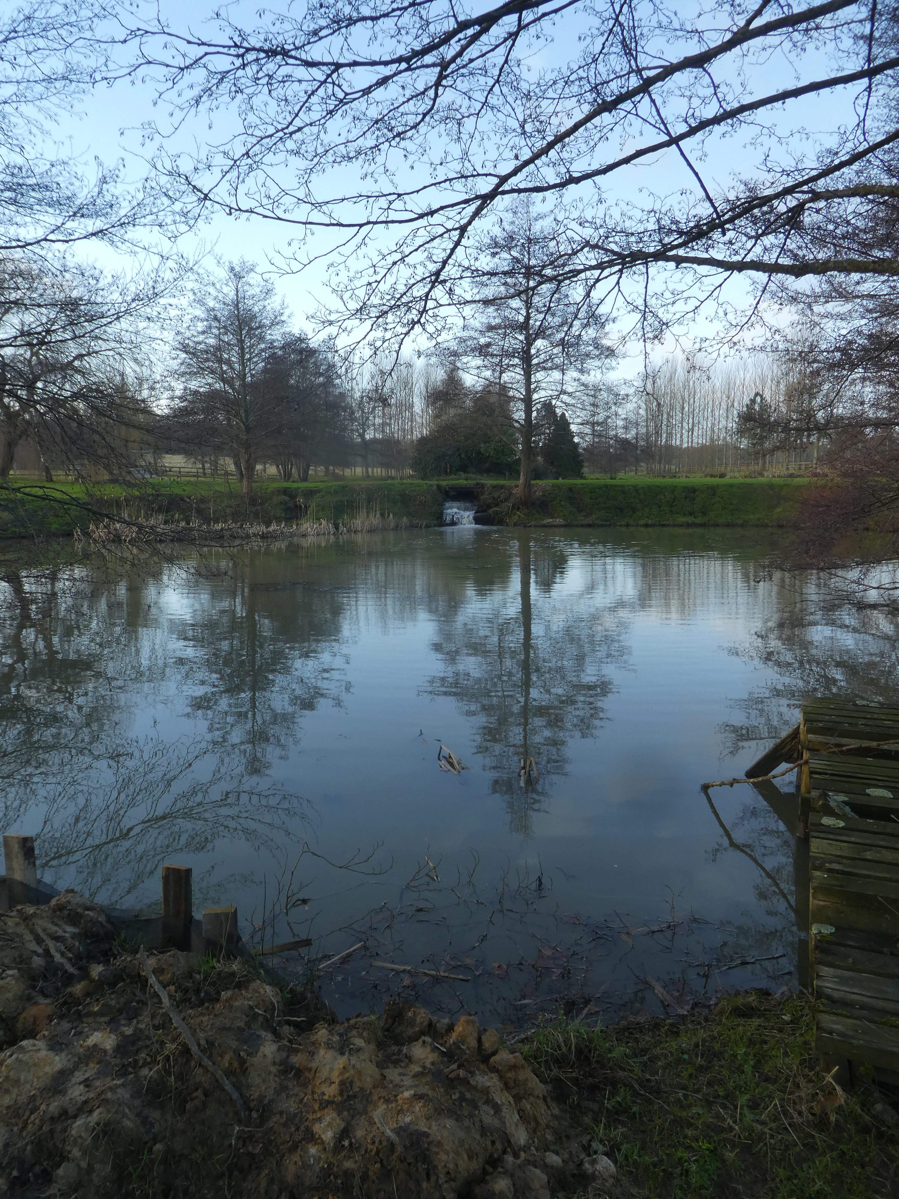
Across waterlogged fields and yet another lake (this time below Old Park
house).
Across more fields and through an open wood, then out to cross the B2115
diagonally.
The track on the other side led past Portways farm and then beside horse fields
heading towards the traffic noise of the A23 hoping for an underpass.
Crossing the 6 lane highway involved following the cycle lane up to the bridge
at the B2115. A couple of shortcuts helped then back down the other side.
A narrow trail between garden fences, until it eventually led to open fields,
which were freshly planted with trees.
down to a stream and across up the other side and climbing up over a hillock.
Across Broxmead lane and down a farm lane.
Across Deaks lane and down beside a garden, that led into Walks wood. This was
Cuckfield park.
In Cuckfield park the paths were all quagmires and I was glad to be wearing
Wellies. finally dropping down to a stream then up the other side. Across the
side of a slope (still exceedingly muddy) before dropping back down to the
stream and across.
Climbing away from the stream (still a quagmire) until we came out at a playing
field at Whitemans Green. Across the B2115 once again and down a lane.
Around a field and onto Cuckfield Golf course - there seemed to be some dispute
about where the path goes between the golf and council offices. We followed the
GPS down the side.
Leaving the side of the golf course we went up the other side of the hedge to
Lower Spark's farm. then down a narrow path to come out on Sparks Lane. A lady
accosted us here about using the dog lead - I explained that I took it off to
lift him over the stile then had to wipe my hands off - she gave in after that
and gave many excuses about rogue owners etc.
The lane ended when it crossed the B2036 at Brook Street. We paused here for a
refreshment break (and trying to stop the rubbing of my boots). then down past
Tanyard farm into the fields again.
the path crossed a sparse wood and into the Borde Hill estate grounds. Here we
picked up a tarmacked farm track
The track led past the big house and the entrance to the gardens - currently
closed - and down to a back road.
We followed Copyhold Lane over the main train line and turned up the SOV trail
where it was now combined with the HWL trail. This crossed fields to River's
farm and over the disused railway line that led to the Bluebell
railway.
Into River's Wood along a muddy trail, which led down to the river Ouse. Here we
left the HWL trail and turned back west to now follow the SOV up the river.
Ahead the Ouse Valley Viaduct, however when we got there it was under
maintenance and the path closed. My initial thought was to take the next path
north, however on the way we past a drive to Ryelands farm and ignored the
"private" sign and walked down it to re-join the path on the other
side.
Past the farm we were back in the fields alongside the river - suitably muddy.
The path came out at Great Bentley Farm.
After the farm the path followed the drive out to the B2036, across this and
down Cherry Lane until we turned off down a drive to Sidnye farm.
A peacock was hiding in the entrance to Sidnye Cottages, then onward to the farm
of the same name. At the farm we followed the signs in a circle before leaving
down a second farm track.
Up the other side of the valley and beside a small wood and fields around to
Bigges farm.
Around the farm with views north and west into Hammerhill Copse. The path came
out onto the B2114. We had to follow this for a short way hugging the edge.
Along the drive way to little Ashfold, before a sharp turn to aim for
Staplefield.
We came out onto the village green and cricket field. Stopping here for a second
refreshment break Then down a lane leading to Tanyard Cottages.
We left the lane on the two strip driveway to Oldhouse. Here the path dropped
steeply down to a footbridge - this was the entrance to Nymans gardens.
We crossed under the lakes of Nymans woodland and then along the side
Part way along the lake we turned up the main drag through the woodland leading
up to the main car park for the NT property. Past here and into the village of
Handcross.
At Handcross we crossed B2114 and then over the A23. Down the slip road until we
could pick up Park road (this was the same as we were on at the beginning of the
day).
We followed the lane down until we came to the junction where we had joined it earlier in the day. We followed this path down past the sheep once again, and through the mud quagmire.
We turned down the road and then into the woods beside it (different to the start as I reckoned we could cross to the lake lower down. We found a bike track and it led to where we wanted. Into the van for food and change of muddy boots, then home.