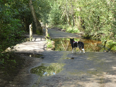
With everything drying after the rain of the last month, Bertie and I went out to see how the paths were improving. The aim was to park at Tilford beside the green, then walk down and around Hankley Common. Across to then around Frensham Common and returning via Farnham Heath.
We parked in the village green parking spot just over the bridge in Tilford. Then set off down the path beside the back road opposite the school and church.The path ended at the second parking spot beside a lane running down to Stockbridge Pond. We followed the lane down to the Angling society car park.
After the pond the track continued as a gravel track rising through the woods on a slightly raised rib as it passed the edge of the golf course.
Into a narrow finger of heath land as it points towards Elstead. Before reaching the edge of the village we turned sharply back on ourselves to follow the other side of the finger.
We followed teh track as it climbed the shoulder of Yagden hill, where we
turned to gain the high point.
Looking across the golf course to the Club House, before continuing over the end of the hill dropping down a water ravaged track.
Over another rise and along the plateau on the top, before dropping down the other side to a junction of tracks Called the Lion's mouth.
From the Lion's mouth we turned along the edge of the training area and golf course - here the path was very soft sand.
The track followed the edge of the golf course on one side and heath land on the other until it crossed Tilford road and down Grange road through the collection of large houses called Rushmoor.
At the edge of the residential area we turned down a bridle way in the woods of scotch pine. The path turned into Frensham common at a junction of tracks.
The track came to the end of a back road and the tarmac transitioned to gravel. The track dropped to a ford with a little pedestrian bridge.
We followed the bridleway into the common and then up to the high point of the southern edge. Along the plateau into the woods.
Dropping down in two sections to reach the edge of A287. Here we took the bridleway that paralleled the road back north opposite the Great Pond.
The path bared away from the road to meet a larger track that turned back to the A287 and crossed it, continuing on the same track into the western side of the common..
A slight error of navigation needed a backtracking and then continued down into Frensham village. We followed a path down the back of houses
The path came out opposite the church, and around the edge of the churchyard before crossing the water meadows beside the river Wey.
A slight rise then more meadows looking up to the higher ground of Millbridge.
The path climbed up the slope to come out into playing fields. We followed the back road into the village to recross the A287. Down the continuing back road past a house with a mural of a dragon.
Just outside the village we found a small track, just beside the road in the scrub. We followed this parallel to the road up to the next road junction at teh corner ot Farnham Heath Nature Reserve.
Into the nature reserve and still parallel to the road (but on the opposite side). We followed the tracks in the reserve as we zigzagged up towards the higher ground at the back.
We climbed up a sandy track to the ridge along the edge of the nature reserve, then along the flatter top.
At teh end of the ridge we dropped down to Tilford road, then along the path parallel to the road to the junction where Sheephatch lane led down to the river Wey (second branch). Down this lane over Tilfordmill Bridge.
Beyond the bridge we turned onto a bridleway climbing up parallel but above the river. Along this bridleway until it merged with a byway at Tilhill house. Leaving the byway when it turned away and along the resultant bridleway down to the bridge in Tilford.
Over the bridge back to the car park, avoiding the goose herding its brood to the river.


