We woke up to rain ... it had snowed a little overnight, however by daylight
it was raining hard and the temperature was above freezing. The cloud was down
over the tops and the lifts were looking empty when we checked the webcams as
well as the fact they were taking the opportunity for some maintenance on the
local lift in Areches.
We spent the morning moping around the apartment then after lunch it stopped ,
and allowed us the opportunity to go for a wander. I had been meaning to have
a look up the valley towards lac de St.-Guerin. The map showed a footpath
leading up to the road to the lac through the village and shortcutting some
hairpins up to the point the road became straighter. I had been up here in the
van last year and turned back at the point the road stopped being ploughed.
Now seemed a good time to explore further and see what opportunities there
were along the route.
The map showed a path that followed the line of the stream - Torrent de
Poncellamont - through the village until it caught up with the D218 after all
the hairpins. We set off through the village to find the start of this path.
We found the footpath signs on the crown of the first road end and followed them
into the residential area below the road.
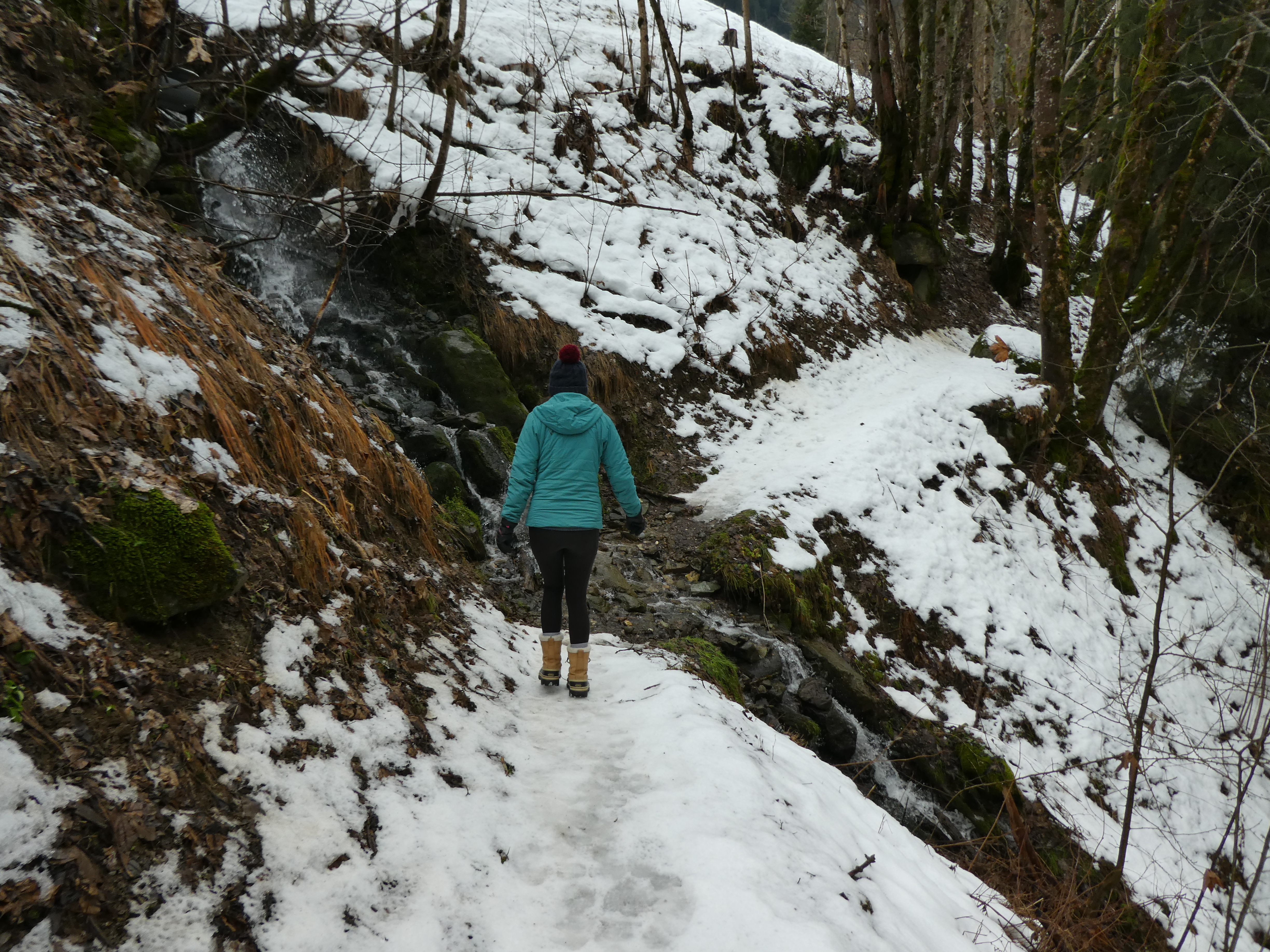
The residential raod ended and the path continued beside the stream. We took the
lower path in our ignorance and followed it across a feeder stream.
The path came to an end at a waterfall - the Cascade du Poncellamont. After
taking this all in we retreated to a path junction to take the alternative.
The alternative path took a higher line above the stream - still following its
course.
At the top of the waterfall we crossed some gullies on a foot bridge
The path continued and under the route des Envers (the road up to the chalets we
had passed on the first ski tour this trip)
The path climbed the other side of the bridge to go down the access road to La
Barme. Then up the side of the farm building.
Up to a second barn and into the field behind it. Then it angled across the
slope towards the D218 on its serpentine ascent.
The col du Pre was definitely no longer an option this trip, and the alternative
slope (other side of the valley to the access road) was also green. The valley
ahead still looked like it held the snow.
The path continued over the snow on the other side of the road cutting through
each of the loops as the road ascended. there were three loops to shortcut.
Up beside the road after the final loop we turned along it and followed it to Le
Mappaz. Just beyond the farm house we passed the barrier that showed the road
blocked - not very effectively. It seemed that beyond it was used as a car
park.
At the road junction beside Le Perthuis the snow plough had turned around. The
road was now covered in snow completely as it continued its rise to the dam.
We continued up the road, and found a number of ski tracks coming down the track
to Le Frassier, but the the foot path beside it looked unused.
We continued along the road for a little bit longer - I think Bryon secretly
though we could reach the dam!
However the sun had now dipped behind the ridge beside us and the temperature
was starting to drop. So when we reached the point marked Ste Barbe (in reality
an agricultural hut) we decided to turn around.
Back down the snowy road to the barrier and onto the cleared section.
We continued down the road (eschewing the shortcuts), and were escorted for a
while by a dog from one of the houses.
We stayed on the road around all the loops and back into the village. We got
distracted by the bar chez Dede, as we passed the church. The internal décor was
defined by all the repurposed skis and paraphernalia. Also of note was the
humour in the opening times notice beside the front door!
A drink all around before we returned the short distance to the apartment.