Last full day in this location for this holiday, and I had been looking at this route all week .. so whilst the others enjoyed a lie in Steph and I set off for Le Plan and the start of the ski resort to head off to the end of the valley. Everyone else would later go up to the col des Aravais and a walk in the sun.
Parking in the main car park (cars are not allowed any further up the track) we got ready in the cold (same as yesterday) temperatures and set off at pace along the track.
It was a kilometer later that the track became covered over with hard packed snow and ice, however it was obvious it was still used by vehicles.
Eventually we reached a pasture where the track divided, the higher one was a sheet of blue ice for 100m so we took the bottom one as the only practical route.
This route kept close to the river (which was where the map said we needed to be).
Crossing several streams (ice mainly) the tracks we were following went up to some barns and out the other side .. we were on the right track as there were markings , but even so it involved another stream crossing, this time with only half a bridge,
This lead up to a track, fairly well used and, heading in the right direction.
The track ended up at a house by the river ... the tracks went through the yard and out the other side ... unfortunately this was a dead end as it was the owners tracks and they lead to a bee hive!
The owner having come to see what we were doing pointed us to the correct route (also telling us the higher route to the left was full of clear patches and not a good ski).
He said to cross the bridge (two planks) and go up the other side and it will be on the left. Otherwise we could keep going up and be on the piste.
Later on we would wonder how bad the upper route would have been after the trials in the wood!!
We followed his advice and went up the wide track on the other side of the stream and headed towards the noise of the piste. ... At least we now knew that coming back we would not have to go down the road.
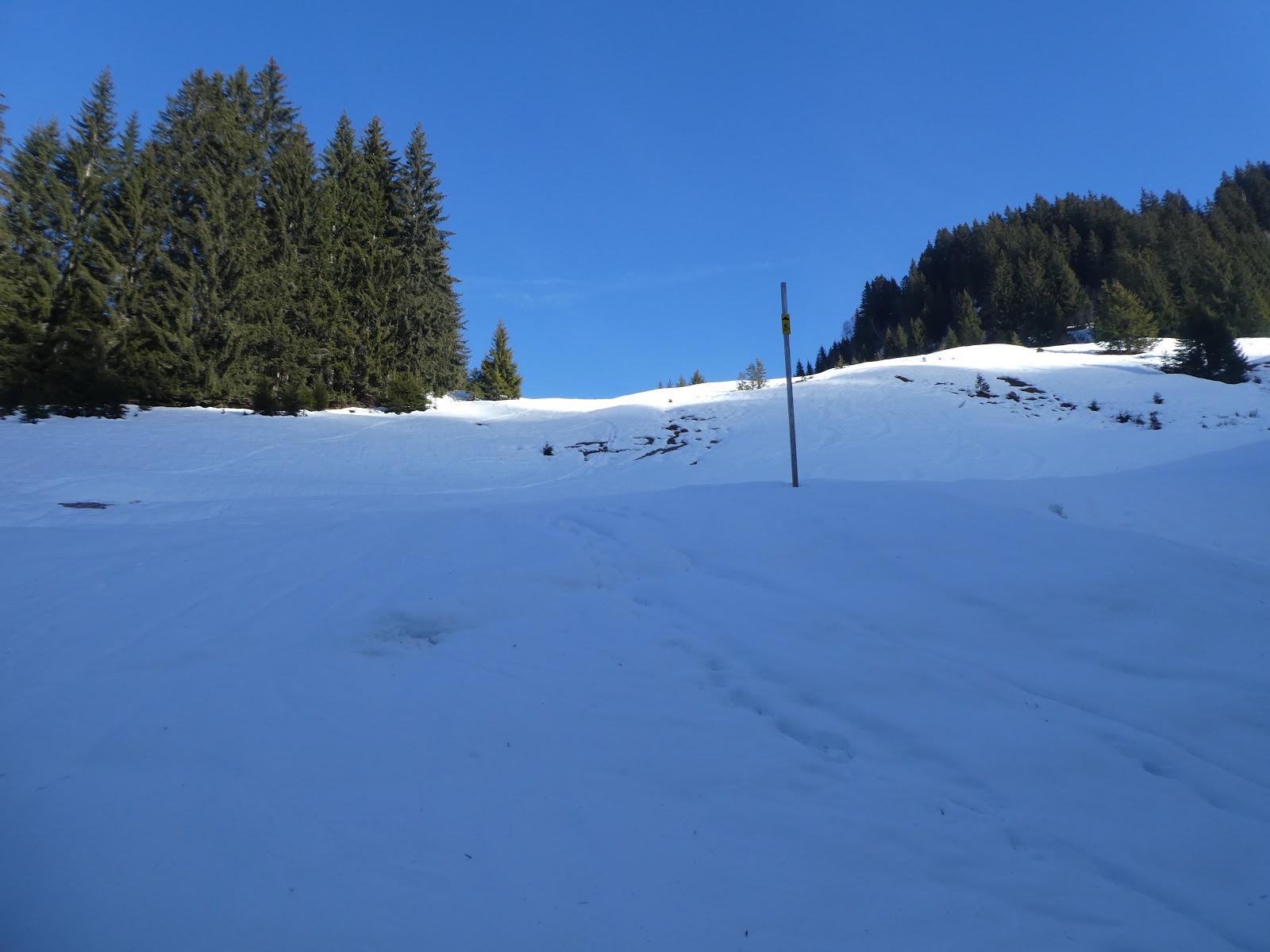
As promised ... and just before the piste was a sign on a tree to the left ... this must be the new trail advertised on the piste map, but where there was no indication ... also we could have got here very easily by skinning up the side of the piste and not had the excitement of the road, then the icy track and several stream crossings.
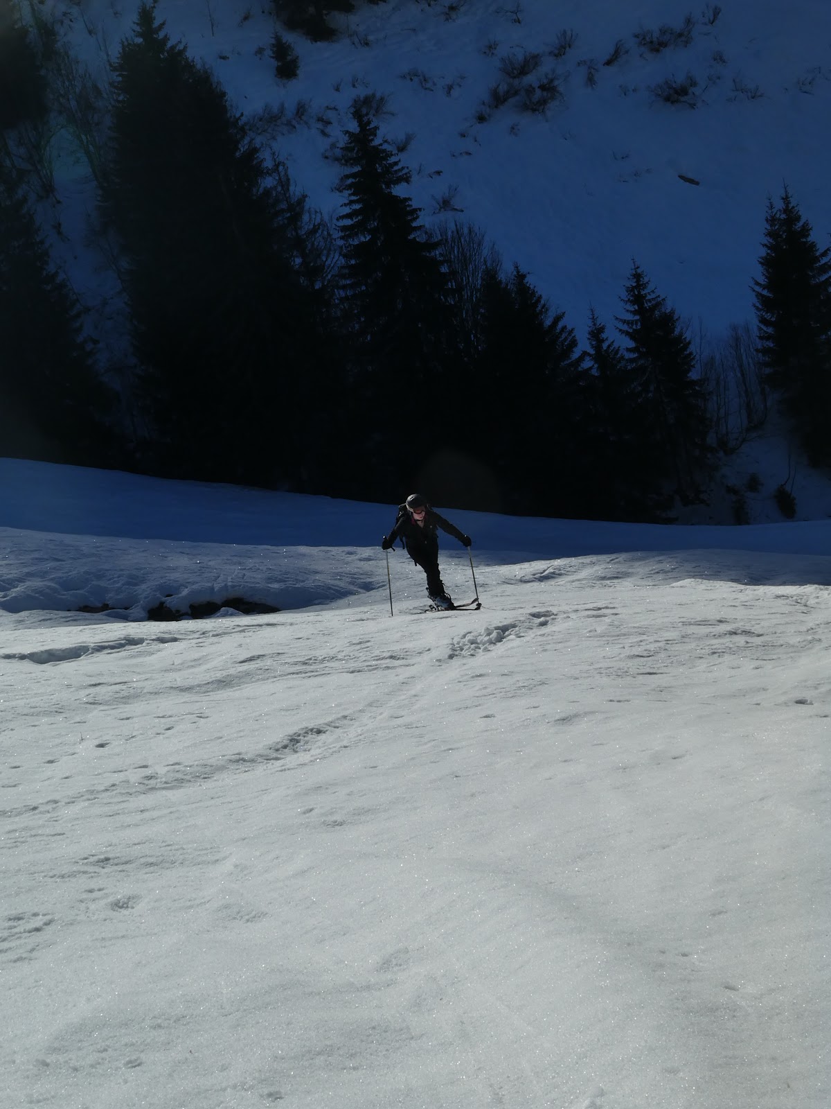
The marked track lead off into the forest ... hard packed and slightly covered in pine debris, but looked well used.
This was the second stage of today's adventure ... following this track ... with occasional signs and always just above the stream.
it started off reasonably well, and cautious
There were a few patches where the track was bare, and there was a lot of up and down, barely gaining height (or that is what it felt like).
Just after we had passed two people skiing down ... not something I was looking forward to at this stage and seriously contemplating walking it when the time came!
The path went down and base was a frozen rivulet to be negotiated.
Eventually things started to open out ...
there was even a path that cut back upwards (but no signs and I still wonder if this lead back to the piste).
After this turn off (that we did not take) the track got a little hard to follow as previous skiers had side slipped the track away, but eventually we found a track marker and knew we were headed in the right direction.. not before crossing yet another stream and going up the steep bank on the other side.
Just after this things really opened out and we crossed a pasture, before the track head back down to the stream.
A much more serious crossing this time and no bridge.. luckily the ice held out and we were able to gingerly step across ... getting out the other side was a complex step-up as the bank was quite high.
With the forest section now over we were into the meadow section ... and the major height gain part of the trip. the way was still signed but very obvious ... straight up the meadow ...
At the top of the first meadow the clearing ran around to the left to a barn on the (initial) skyline.
this took us to the point where we would have joined had we taken the upper path from the first diverging point. looking back at the track I was not sure how mare it actually was - probably similar to the Croix des butts route.
However it was an option for the return.
From this barn the slope angled up to the right. Initially quite seep and icy - maybe the crampons but I got away without. then through some shrubs to open out in the next big meadow (which also when up to another chalet) ..
This was steadier going but still much more ascent than we had done this trip so far.
Getting to the chalet only showed yet another slope above it leading to one more another chalet.
the slope up to the final chalet was cut by a track that zigzagged across the slope and made the last tiring push a little easier.
At the chalet we two men sat around a fire .. i wondered how they had got there before they got up and after putting the chairs away in the chalet and dousing the fire walked up to the ridge line and hopped on a skidoo ... we had returned to the mechanized world.
The top was just around the corner and just the inconsequential bump on the ridge that was expected, but the views across to Mont Blanc were excellent.
We stopped to have a bite and regain some energy for the descent, which was now going ot be from the top station of the ski area at Le Christomet .. the signs lead there and I did not want to go down the forest track if there was a better way.
the Aravais ridge
the next section of the ascent ... back to the ski area.
There was a wide track from here heading to the top station at Le Christomet, after a few meters it started to drop down ... knowing it could not go down far before having to go up again, we chose to leave the skins on the skis and walk down... this was a good move as the track was bare for half the height of the descent.
then it was back on the skis to start the ascent.
the final climb started off slowly then steepened as it rose up to the top station.
the last few meters were on the side of the blue descent to Megeve.
The top station, and the end of 700Hm climb ... time to get layered up for the descent ... from our previous days we knew that the descent (blue) track was cold, very cold.
Good views of the top sections of the route. This is definitely a good way up and it is useful to see the ski areas marking routes like these. hopefully this will be properly documented in the coming years.