A sanction busting walk today ... trying to get away from the local mud wallows and take advantage of the bitterly cold weather, we took a ride down to Pulborough aiming to have a walk and do the weekly shopping in one trip. Parking at the view point above Duncton the aim was to work our way across to Bignor hill and then come back along the South Downs way ... another piece of that particular jigsaw.


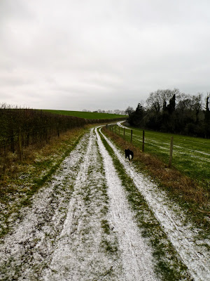
Not much snow on the ground, but certainly very frosted.


Up the other side ... not quite so steep - in the distance you can see the radio masts which we would pass later,

 Lots of signs about the red tractor farming, the track followed a wooded line between the fields where they were building a wildlife friendly environment.


The track angled upwards slightly.

 Looking back to the earlier undulations, before continuing on a track, still heading for the radio masts.

 Across more open pasture and we entered into the national trust land by the radio masts.


From here the path was fairly level as it crossed to the car park below bignor hill.
Up above the kites were wheeling in the wind.


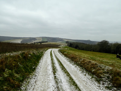
 Bignor hill in the distance with the way over to Amberley.


the carpark was windy and brutally cold.
A quick pause for a warming coffee before turning around and taking the downs way back.
 Across a huge pasture field, following the fence line to its end at a cross ways of tracks, battered by the wind coming from a northerly direction.


The track became more of a farm vehicle access way, through more fields still exposed to the wind.
The view opened out and it was possible to see over to the other side of the road and valley, together with the white scar we would follow up it.

 Still on the farm vehicle track, it cleared some woods and dropped steeply down to the valley and the Chichester road. The surface was treacherous with the snow/ frost making the surface very slippery.


Across the bottom to the road at the farm buildings.


Bitterly cold and exposed, it was only a passing chinook that broke the tedium of the climb.


Not far beyond this we came to the cross paths, where we would leave the South Downs Way and cut back down to the car park and van.
The signpost with its weather cap was notable.

 From here we followed a wide track down through the woods again, a gentle gradient and in a half circle around what turned out to be a chalk quarry.


Back at the road there was a small track back to the car park.
 Back at the van ... the freezing wind still dominant, with occasional flurries of snow.

The viewpoint has a display showing hte prominant features normally visible .. we could just make out vague shapes in the distance, but a good place to park up.
Picnic in the van - Bertie would be concerned if he had gone all this way with out a reward! then back home via the supermarket.

