
Another piece of the South Downs way jigsaw.


taking a road which lead to the college grounds, but with a warning about sat navs, as it only feeds the cottages.

 This lane ran along the side of the college playing fields, passing all the cottages. then around the main building - probably the old manor house, before cutting into the woods around the perimeter wall.


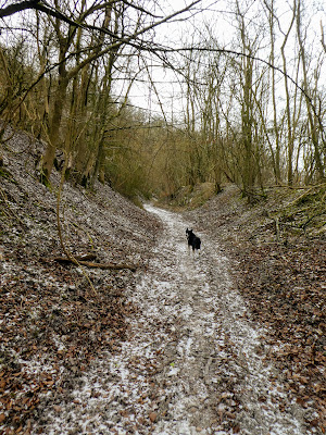
This changed into a forestry track, in the chalk.

 A strange warning sign on the side of the track as it undulated along the side of the slope... the surface was quite rutted, but with the frost making it solid.

 Fed up with the hard work on the track, we cut down across the short grass section onto the college drive, around the stud farm.


The track got a little tedious following every contour of the slope in and out up and down.


Although the wind howled along this it was much easier walking than on the track.

 The drive way ended at a pretentious gatehouse and gate way, before turning around to the church and school.


There was plenty of parking on the side of the road here, with a number of cars taking advantage.
I did like the massive old Yew trees around the graveyard.

 A short section on the road then we cut up on another forest track - slightly less rutted, as it cut back up to the side of the ridge, before traversing westward ... here we entered the Grafham reserve - an attempt to preserve the iron age aspects of the area.
 The track angled upwards slanting across the slope in a steady traverse to the top of the ridge. Definitely very crispy underfoot.


Before long we emerged out onto the top, which was really not much different to the wooded side, except flatter, and with enclosed areas where the reserve was doing restoration efforts.

 We continued westward on the ridge to reach the spot height where the literary trail joins.


Time for a break and snack before turning back into the wind and returning along the top of the ridge.
Here it was easier to see the restoration efforts and the isolated paddocks - keeping all but the walkers out.
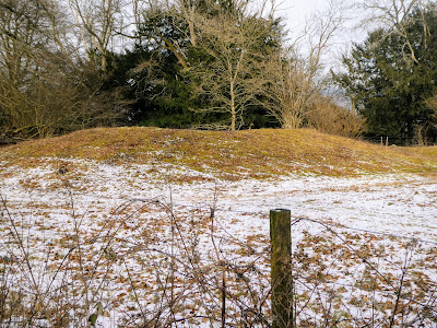
 On this section of the downs there are a large number of "barrows" - ancient burial sites, most with yew trees nearby and generally in the fenced off paddocks.


the track meandered to the left and right of these areas, generally in the trees which helped shelter the way from the wind.

 Another wonderful old signpost with a lead cap - there was one on the last walk just up the track from here.


Now everything opened out as we came to the end of the reserve and the fields took over.


Back home to warm up by the fire.

