Bertie and I headed out to do another section of the North Downs Way, starting
a Puttenham Common and making our way, cross country, to the point we had
reached last time we were this way at Watts gallery, before coming back along
the North downs way. However as we were walking around, it seemed as though we
were doing a tour of all the pubs we had the office christmas lunch in (on
this side of Guildford).
Parking in the "top" carpark at the common, which is a huge area, and seemed
to be the local haunt of all the dog walkers. We did have to creep under the
barrier (tight at 1.95m). We departed in the general direction of Guildford
along the bridleway heading away from the common towards Shackleford. The sun was out in a cloudless sky, however the wind kept the temperature down enough to wear several layers.


The bridleway ended on a minor road which we then had to follow into the
village.

 The early morning sun and blue sky giving excellent reflections in a pond as
we passed. Approaching the village with the morning mist burning off, but also
reinforced with smoke from boilers.
The early morning sun and blue sky giving excellent reflections in a pond as
we passed. Approaching the village with the morning mist burning off, but also
reinforced with smoke from boilers.

 The first pub of the day as we passed Cyder house Inn, scene of several
departmental xmas lunches, then cutting up Rokers lane - the drive way to
several houses,before it turned into a bridle path.
The first pub of the day as we passed Cyder house Inn, scene of several
departmental xmas lunches, then cutting up Rokers lane - the drive way to
several houses,before it turned into a bridle path.
 The bridle way was very wide and mown grass... I could only guess that
it was used to train racehorses. Before this track arrived at the A3 there was
a gate across and a sign warning that there was no easy way across the dual
carriageway, and it recommended a diversion via the road underpass. We took
the obvious solution and turned down a path between large houses (another
feature of today's walk).
The bridle way was very wide and mown grass... I could only guess that
it was used to train racehorses. Before this track arrived at the A3 there was
a gate across and a sign warning that there was no easy way across the dual
carriageway, and it recommended a diversion via the road underpass. We took
the obvious solution and turned down a path between large houses (another
feature of today's walk).

 The diversion came out at the road, however on the Norney side of the A3 there
was a "horse refuge" along the side - seemed more like a path to me. On the
other side of the underpass we passed the second of the Xmas lunch pubs - The
Squirrel, before the path ran out and we had to resort to walking along the
road until picking the pavement up in the Hurtmore village.
The diversion came out at the road, however on the Norney side of the A3 there
was a "horse refuge" along the side - seemed more like a path to me. On the
other side of the underpass we passed the second of the Xmas lunch pubs - The
Squirrel, before the path ran out and we had to resort to walking along the
road until picking the pavement up in the Hurtmore village.

 Picking up a path through the woods, however we missed the turning we had
planned and ended up coming out on the borders of Charterhouse school, and
having to backtrack along the subsequent road.
Picking up a path through the woods, however we missed the turning we had
planned and ended up coming out on the borders of Charterhouse school, and
having to backtrack along the subsequent road.

 Back on track a "private" road through an estate of huge houses with special
measures to keep away the unwashed was at odds wit the public access, before
it changed into a path beside a wood dropping down to grazing fields below.
Back on track a "private" road through an estate of huge houses with special
measures to keep away the unwashed was at odds wit the public access, before
it changed into a path beside a wood dropping down to grazing fields below.

 Large open fields, thankfully without their bovine residents for the winter.
This came out in the village of Compton in the car park of the Lemongrass (I
am sure it was not called that when we were last there).
Large open fields, thankfully without their bovine residents for the winter.
This came out in the village of Compton in the car park of the Lemongrass (I
am sure it was not called that when we were last there).

 The telephone box on Compton Common always used to be "decorated" by the
residents for effect, but now it seems to be less well supported. We passed by
and crossed the common before turning down the Polsted lane. Opposite the
junction to my favourite pub around here - The Withies - we turned onto a path
through Bummore Copse
The telephone box on Compton Common always used to be "decorated" by the
residents for effect, but now it seems to be less well supported. We passed by
and crossed the common before turning down the Polsted lane. Opposite the
junction to my favourite pub around here - The Withies - we turned onto a path
through Bummore Copse

 This track came out beside a livery yard and a path we had walked down last
time we were here. Walking down the driveway and up around the sides of the
yard, to drop down to the road beside Watts gallery.
This track came out beside a livery yard and a path we had walked down last
time we were here. Walking down the driveway and up around the sides of the
yard, to drop down to the road beside Watts gallery.

 Directly opposite, the path continued down a road under the A3 once more. We
did stop here on a suitable tree trunk in the sun for a short break- just over
half way.
Directly opposite, the path continued down a road under the A3 once more. We
did stop here on a suitable tree trunk in the sun for a short break- just over
half way.

 Now on the North Downs way as it worked through the Hurt Hills and passed
isolated houses
Now on the North Downs way as it worked through the Hurt Hills and passed
isolated houses

 The track continued alongside Puttenham golf course (suitably separated by
hedges on both sides), until coming out beside the car park for the Jolly
Farmer - used to be a beefeater or similar chain, then turning down the road
to Puttenham village and passed the Good Intent - another Xmas party pub
The track continued alongside Puttenham golf course (suitably separated by
hedges on both sides), until coming out beside the car park for the Jolly
Farmer - used to be a beefeater or similar chain, then turning down the road
to Puttenham village and passed the Good Intent - another Xmas party pub

 The North Downs way continued through the village and out the other side
before continuing up a single track lane (without passing places, where we had
to jump the bank to get out of the way of a car, then again as it reversed to
let another car passed, and once more as it came back up!).
The North Downs way continued through the village and out the other side
before continuing up a single track lane (without passing places, where we had
to jump the bank to get out of the way of a car, then again as it reversed to
let another car passed, and once more as it came back up!).


The lane ended at some farm cottages beside Little Common where it changed
into a hogging path

 Out on Puttenham common once more and the NDW passed beside the heathland and
down into woods as it dropped to the stream. Here we turned south to follow
the stream and ponds back to the car parks
Out on Puttenham common once more and the NDW passed beside the heathland and
down into woods as it dropped to the stream. Here we turned south to follow
the stream and ponds back to the car parks

 Through the woods and up to the remains of an iron age hill fort - not really
noticeable from this side, but the earth banks were on the other side.
Through the woods and up to the remains of an iron age hill fort - not really
noticeable from this side, but the earth banks were on the other side.

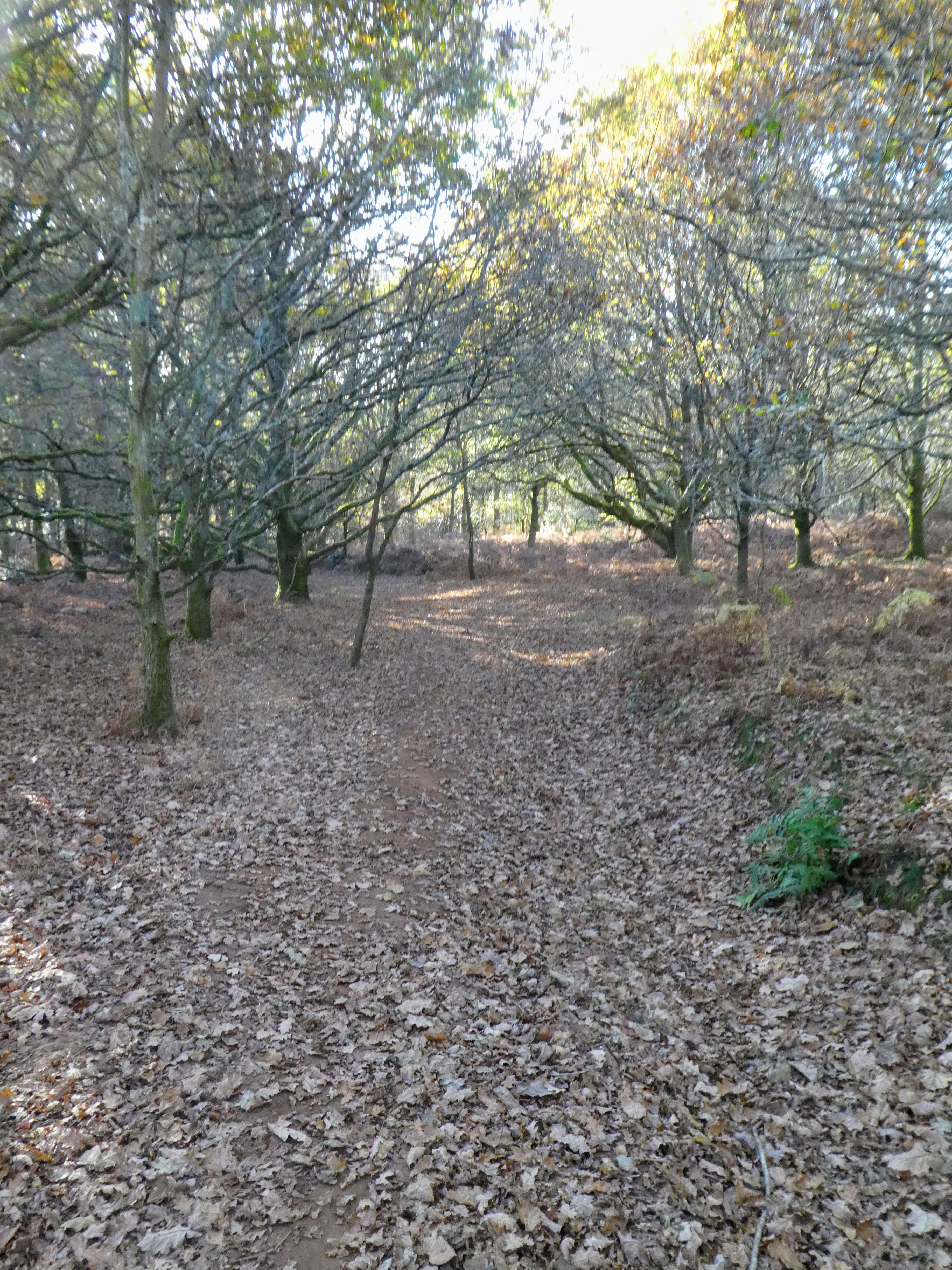
 Through the ramparts and down the other side along leaf strewn paths. To our
right we could hear water birds arguing, but the trees hid the water
Through the ramparts and down the other side along leaf strewn paths. To our
right we could hear water birds arguing, but the trees hid the water

 General's pond was the first sign of water, but it was unconnected to the
unseen Tarn to our right. We turned away from the water and through the woods
back towards the car park.
General's pond was the first sign of water, but it was unconnected to the
unseen Tarn to our right. We turned away from the water and through the woods
back towards the car park.

 The middle car park - larger than it looked from the road, and we turned slightly to parallel the road whilst keeping in the trees.

 Coming out at the heathland below the to car park, where we took the direct route through the grass tussocks up the slope and back to the van and a welcome picnic sitting in the sun out of the bitter wind that had followed us all day.
Views of the hogs back dominate the skyline to the north


One final look at the view across to Farnham and beyond before heading home.