After the storms of this week, we have a clear day before the next front comes
through. Bertie and I made for Frensham Common, where I had worked out a route
taking in some of the MoD managed access training areas. We arrived at the NT
carpark near Frensham Little Pond, making use of the membership for free
parking. The car park was more crowded than I expected for a weekday morning,
but as we would find out, that it was dog walking central.
We walked around to the end of the "Little" Pond, and the weir managing the
water level, Then picked up the bridleway skirting around the pond.
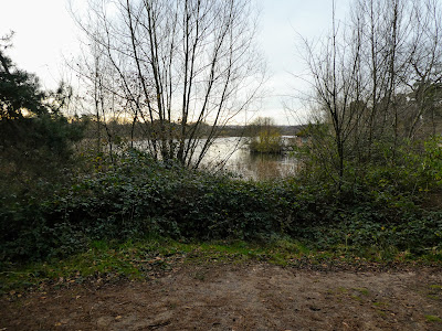
Looking across the pond.
The path winds its way through pine trees around the side of the pond. Finally
we escaped from the dog walking and exercise groups as we followed the path
out of the NT area.
After passing through a fenced off trail between fields the trail went through
a pine wood eventually merging into another bridleway
The bridleway met a track, through some swamp like areas including a ford, we
then split off the track onto a path leading back into Frensham common.
We chose to climb up on of the nearby tops ... we could have traversed
the slope lower down, however the views from the top , especially over and
beyond the "great" pond.
From the top we continued along the ridge before cutting down to Crosswater
and picking up the house drive.
Turning up the permissive track leading into an area known as "the Flashes" -
a large heathery basin flat in the main, but wooded hillsides up tot eh right
hand side.
Skirting around the grasslands and the hills known as The Devil's Jumps -
fenced off from public access. the first (High Jump) is fully wooded
The second of the Jumps (Middle Jump) behind a field marked the point of
opening out, but also showing a third bump (Stony Jump) rising up.
The steep path got even more steeper nearer the top made even harder by the
erosion. However the sun broke through as we got to the top.
The views were all around, including across to where we had come from and even
up towards Crooksbury hill and the antennae next door.
The views to the south over the Sculpture park.
Looking down across the Flashes, before dropping down again and traversing
around to the entrance to the area.
Crossing the road and after a short access track we entered into the MoD
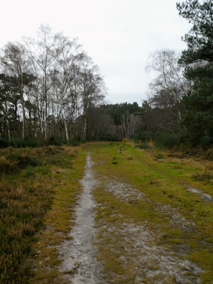
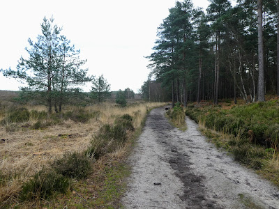
Training area of Hankley Common. Much like many of the these areas in this
region ... sandy tracks around pine treed outcrops
After keeping near the edge for a while to find the correct track into the
middle following a straight line on the map. Up over a ridge and down the
otherside into the central valley of the area. Once the track ended we followed
game tracks up onto the ridge of Kettlebury Hill
Once on the ridge turning onto the wide track along the ridge line, out of the
trees into open heathland, still aiming for an exit opposite where we entered
the area.
Following smaller tracks but on a bearing we dropped out of the training area
before rising up to a road, and a new track in roughly the same direction
... this track dropped down to a stream in a peaceful meadow. This led to
a sunken track that climbed to the road to a village - Thursley
Taking a shortcut track to the village which came out in the middle by the
pub.
Taking the bridleway north from the centre down into the woods, an daround the
extension to the MoD training area. Taking the access road to the parking areas
of the training area, we headed once more back inside.
Unfortunately the track up to the parking area and heathland was blighted by a
steady stream of vehicles going both ways on a single track lane. Up at the
parking area it was full of a complete film setup . Thankfully the bridleway was
still open and we walked through the chaos and out into the heathland.
Climbing up to Lion's Mouth, there were portaloos every quarter kilometer,
presumably for the filming.
At a junction of many tracks - far more than shown on the map. I chose a track
into the golf course however it was slightly off and I had to follow a hole or
two to get back onto the right bridlepath.
The path ended at the clubhouse, where we took a 90 deg turn adn skirted the
edge of the golf course, alongside the renovation work going on.
The end of the golf course was at a large pond - Stockbridge pond. Here we picked up a lane initially just a dirt track
Turned into tarmaced after passing a horse stables, with loads of cross country fences set up in the fields.
The lane ended at the car park just south of Tilford
Crossing the road, and following a multiaccess lane through the woods, mostly with "private land" signs on both sides to keep people on the track.
The track took us directly back to the car park and the van. Time for a picnic and relaxing before heading home.


 At a junction of many tracks - far more than shown on the map. I chose a track
into the golf course however it was slightly off and I had to follow a hole or
two to get back onto the right bridlepath.
At a junction of many tracks - far more than shown on the map. I chose a track
into the golf course however it was slightly off and I had to follow a hole or
two to get back onto the right bridlepath.
 The path ended at the clubhouse, where we took a 90 deg turn adn skirted the
edge of the golf course, alongside the renovation work going on.
The path ended at the clubhouse, where we took a 90 deg turn adn skirted the
edge of the golf course, alongside the renovation work going on.
 The end of the golf course was at a large pond - Stockbridge pond. Here we picked up a lane initially just a dirt track
 Turned into tarmaced after passing a horse stables, with loads of cross country fences set up in the fields.
 Crossing the road, and following a multiaccess lane through the woods, mostly with "private land" signs on both sides to keep people on the track.
 The track took us directly back to the car park and the van. Time for a picnic and relaxing before heading home.