Not a cloud in sight this morning as we woke, however there was still a strong wind, even more than yesterday, so
we needed a low level trip. Yesterday we went up the valley, so the logic
dictated that today we go the other way, and down to St. Judok. This also included an
opportunity to come back via a disused ski tow on the northern side of the
valley.
We set off in the cold, but sunny early morning, down to the centre of the
village, and picked up the road down the valley.
The village is long and drawn out along the road, and we walked to the lower
end, before taking the "old" road on the opposite side of the valley to the main
road.
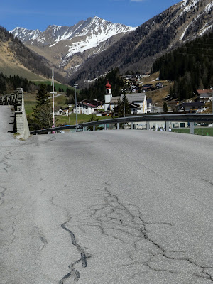
The "old" road followed the river down the valley past a hydro scheme (with lots
of debris over the leate take off). The river dropping down over several "steps". This section was barred from traffic in general.
The road crossed over and continued steeply down the valley following the river,
until we met civilisation once more at the outskirts to St. Judok.
Coming out by the railway as it curved around above the village centre, and then
followed it to the station.
We continued on the path beside the railway as it continued around the valley
end until we met the point the path to the via Ferrata left it climbing up to
the cliffs above, where there were already a number of people on the via
Ferrata.
At this point I realised that I was heading off route - too far along the valley
to pick up the route to Hochgeneiner - it is a problem of using a sat nav in
place of a larger more overview map. So we returned until we could pick up a
path beside a chapel heading uphill.
This path merged with a road that snaked around some avalanche protection bunds
climbing gently into the trees.
We left the road where a broken sign indicated that the narrow trail heading
very steeply up into the trees was the route we were after.
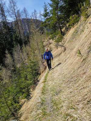
The climbing continued winding steeply up through the woods, before easing
slightly and traversing across the slope.
The objective danger of this very narrow path cutting across the grass and tree
covered slope.
After a while we stopped at a convenient semi cave beside a babbling brook for
some refreshments, before continuing ever upwards.
Suddenly the path emerged from the trees and we came out at some pasture looking
across to the farm that now replaces the lower ski lift. the pasture would have
previously been the ski slope.
Climbing up and across to the farm we merged onto a road/ drive to the farm.
Following the road gently downhill and then a couple of hairpins and some more
road in the general direction of the apartment.
Down in the valley we merged back onto the road we used on the descent this
morning and followed it back up to the village, continuing through it and up the final climb to the apartment.


