We had been working up to this day since we changed apartments, the longest and
most ascent route so far. We had planned to go around to the next valley north
and climb the Kreuzjoch from the end of the road. Getting up a hour earlier
would allow us to stick to the mantra of being ready to return by noon, and we
were packed and on the road by our normal rising time.
8am and we were parked, ticket bought (the first paid for parking space we had
used this trip), and ready to climb. The route started at a parking site at the
bottom of a rodelbahn (taboggan run), and followed a track up to the Navis hutte
at the top of the woods.
The start of the track was iced over and we had hopes that it would soon be
capable for skinning. We were to be disappointed, and it very soon was apparent
that the road had been used a lot and there was a dearth of any cover over the
dirt apart for the occasional patch of ice.
Initially this followed a very structured track with side supports and lots of
advertising, however we soon left it behind as we continued up the corridor
through the trees.
This was very dispiriting, not only could we not see much (apart form the
occasional opening to look down the valley - typically at a hairpin) but we had
no idea how far it would go on.
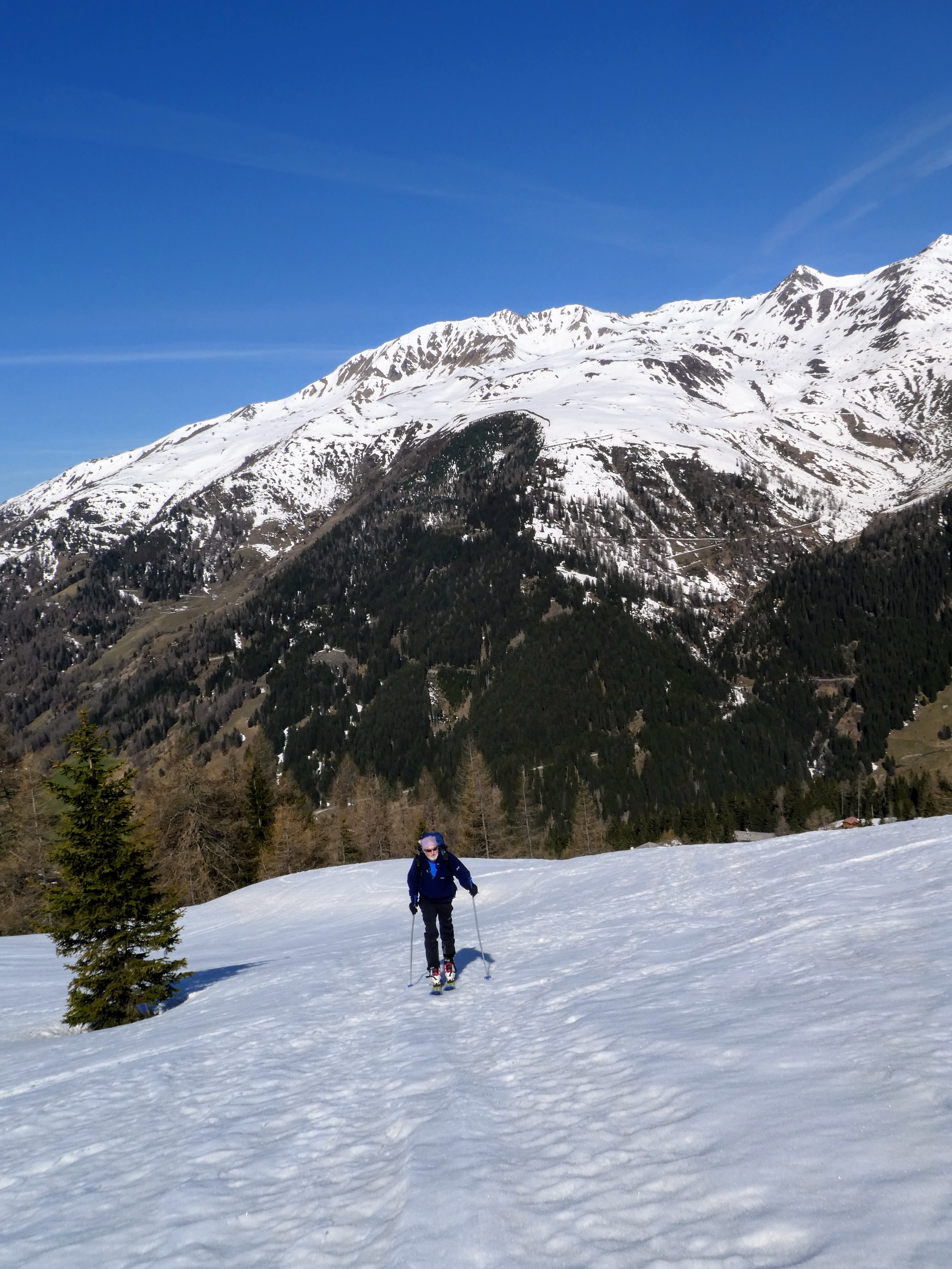
Everything changed when we finally got to the Naviser Hutte, the track now was
not cleared and so passable on skins, and also the trees got sparse, as we
started into the upper pasture areas.
From the hutte we continued on the track, now on skis, to the next building up
the slope - Stocklalm, where we were finally in the upper pasture land.
the pasture area was undulating slopes converging on a valley with ridges on
both side.
We started up the middle aiming to get on the bottom of the right hand ridge.
We climbed up the end of the ridge in some sparse trees, and came out on the
ridge top, following an old skinning track.
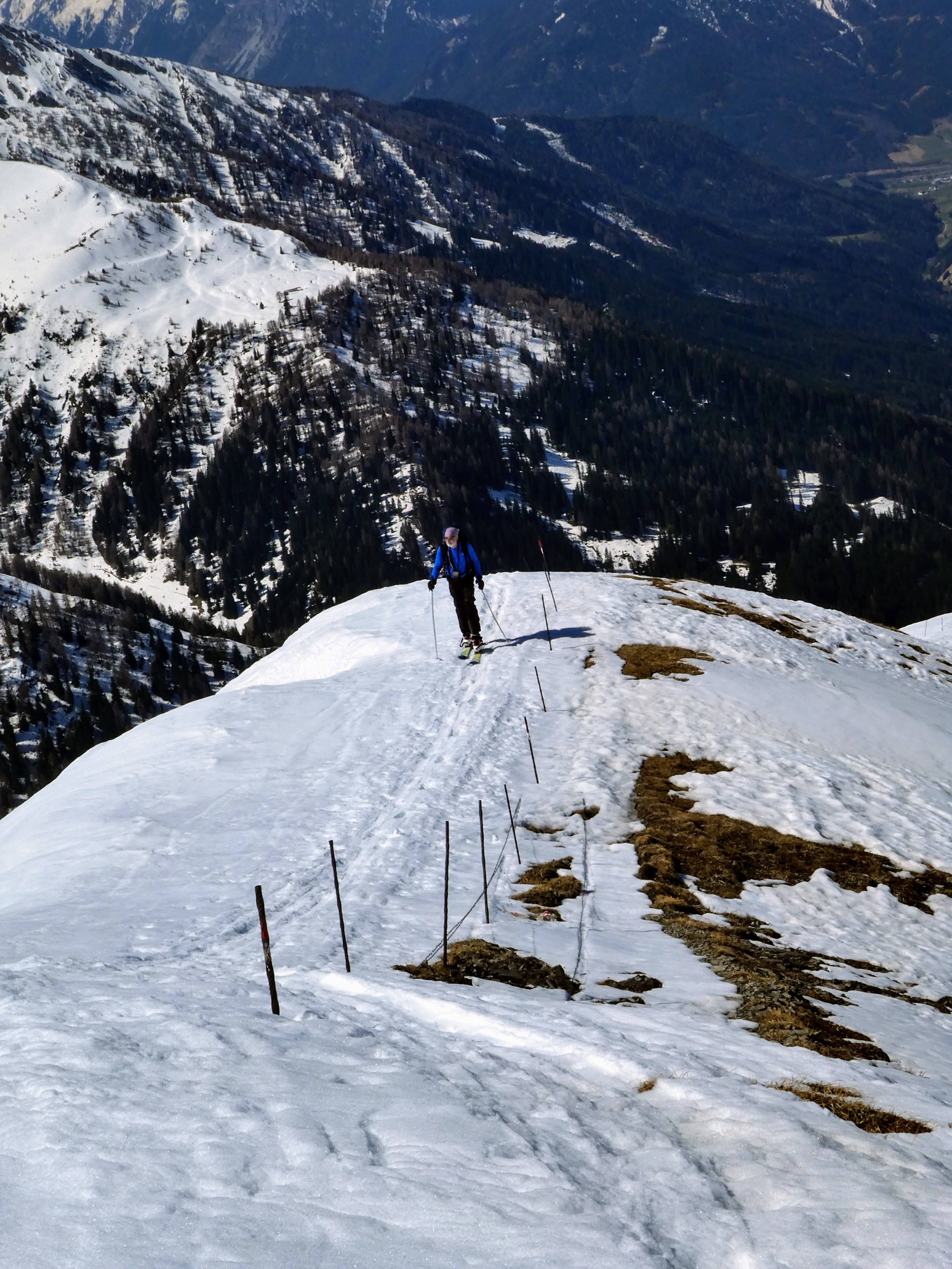
From here we would follow a barbed wire fence all the way to the top, however
there were some repetitious issues where the snow had melted and we had to
divert slightly, the first was up a steep hard snow gully with some bushes at
the end.
Now we left the trees behind and followed the open ridge, going over a number of
undulations as we climbed higher.
The first large round top on this ridge had hidden the continuation behind as we
saw once we got close. My assumption of the fence post being a cross was
disapated once the tracks continued around the snow to the side.
Coming out at a selle - flatter area at the top of a confluence of valleys, here
we could see another peak after a ridge rising out of this selle.
We climbed up onto the ridge over the end slope
Following this narrow route towards the summit.
This came to a very narrow flatter section with steep slopes on each side, and
beyind this we could now see the summit cross - on another peak beyond this
ridge! At the end there was a drop down before the final rise to the summit. The
descent would have to be done on foot, and without skis or snowshoes this would
be a challenge as the snow was soft. Looking down the western side we could see
a route where people had avoided this descent by traversing below the ridgeline,
however the slope looked a very prime candidate for an avalanche.
This was it ... self survival cut in and we turned around to go to the other end
of the ridge for a snack before stripping the skins off. We had reached our high
point for the day. (also helped by the fact that we were close to our turn
around time of noon)
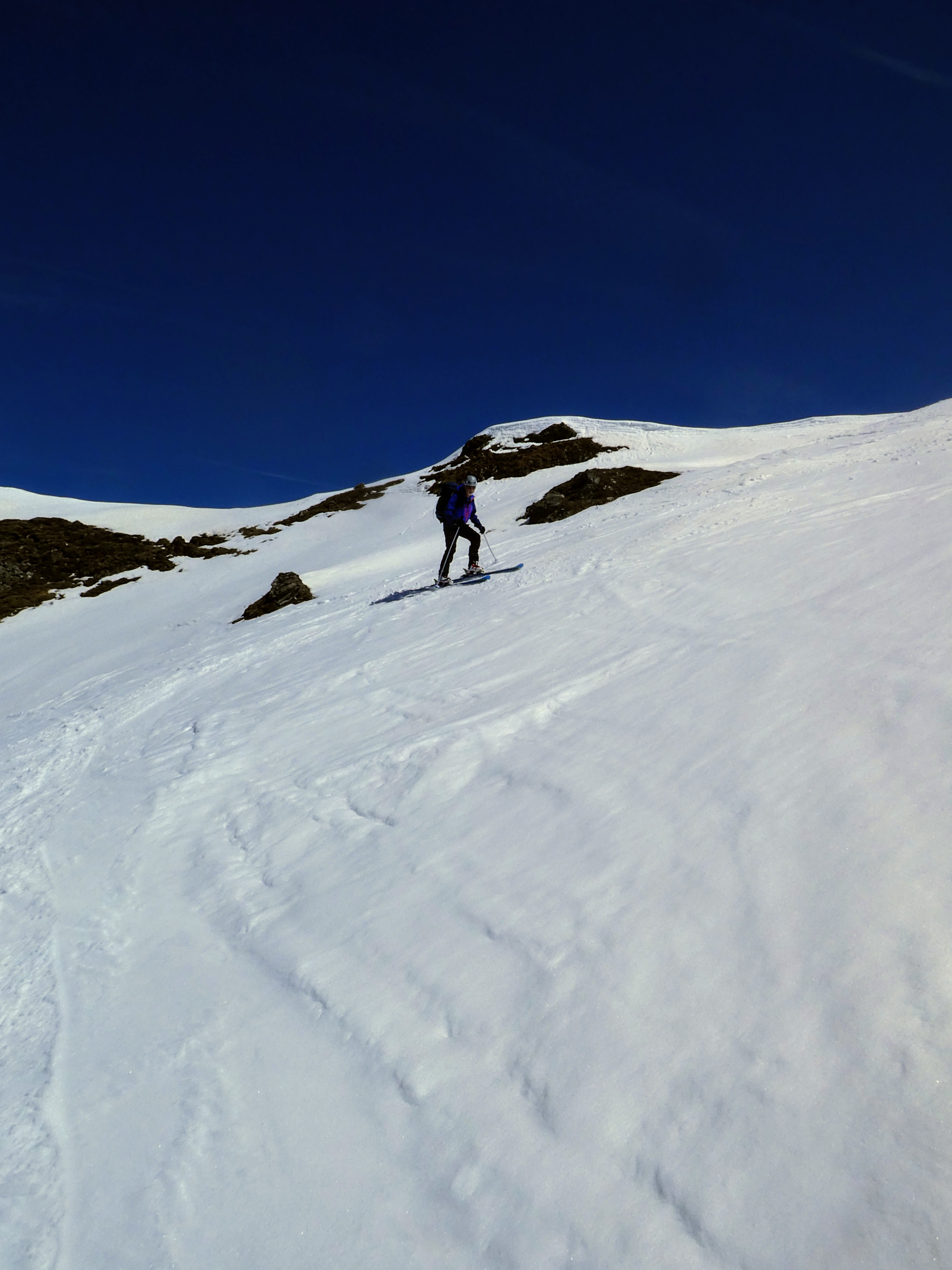
The descent started from the side of the ridge with a steep step then a
shallower entry into a bowl. the snow in the east side of the ridge was better
than the other and we were able to put in a number of careful turns.
Entering the bowl the slope was rock hard and fairly steep, but there was enough
to put in turns.
Down on the selle we crossed it to a huge cross on the top of a bump that marked
the beginning of the descent down the valley we had followed on the ridge during
the ascent.
Another bowl, this time the snow was perfect and as such we were down at the
pasture area very quickly.
Over the pasture undulations in similar conditions but getting a little heavier.
Back at the top farm we dropped down the fields beyond the house, which saved
going around the track, here the snow was now much heavier and with tired legs
made things more effort.
We came of the field just above the hutte and sped down the track, and took a
break in the sun on the veranda. The hutte was closed, however a large sign
indicated a drinks vending machine - only it was switched off!
Building up for the final footslog down the track to the van ... more mental
than physical, and very little interest.
Footsore and weary we reached the van, and some welcome refreshments. Our longest route so far, and not helped by 300m height diff. on bare roads to start and finish. This was the start of the end of the season at this altitude!