31 December 2022

2022 Annual Overview

This shows a summary of the longer walks partaken of this year. It does not include the daily dog walks, nor the local repetitive walks (for example the Saturday Bread Run, or the Surgery Visits, etc.)

Now Lock Down was so last year and freedom to roam was back on the agenda, I started going for even longer walks. This included doing sections of the long distance paths around the area - North Downs, South Downs, Serpents way, Downs Link and Greensand way among others. There was no new year trip to the alps, but we did manage a Spring Tour.

 The goal this year is to do 1600 Km or 1000 miles walking .. combination of local walks and short stays - the alpine trips were still off the agenda. I actually came very close to 2000Km - a late increase in the target.


30 December 2022

Petworth Park Stroll, Local

 We woke up to heavy rain, however this was forecast to stop around lunchtime, so I settled in to do a few odd jobs for the morning, then set off for Petworth park after lunch. The rain had settled down, but there was a lot of surface water lying around. Foxbridge lane was flooded at the Plaistow end, and the river at Balls cross was only just about flowing under the bridge. We parked up in the second Petworth car park - the one at the northern end of the deer park.

The rain stopped as we were driving over, so we jumped out and set off across the end of the deer park. The idea was to walk around the edge (the long way around) back to the big house then cut into the town. We would then circle around back to the car park using the path we had walked from home previously in the year.
The view from the top of the park looking south.
We picked up the semi tarmacked track coming from the lodge that cut through the park, with views down to the upper pond.
Staying on the slopes above the pond we continued around the edge of the park.
As we moved towards the A272 at the southern end of the park we passed the deer herd hiding up in a corner towards the village of Tillington. At the road we stayed in the park and followed the wall along to the cricket pitch, where we had to avoid cutting back to the big house.
As we passed close to the Upper pond looking across to the boat house, then up to the big house.
To the left of the house there was an underpass that led to the cowyard and from that to the town. We then picked up the path opposite the church leading down to a path that cut the slope around the edge of the town.
Crossing the A283 and down the slope to where we had hoped to cross the little stream. However this was now in flood and had broken through beyond the footbridge. So we turned around and back to the town bypass path.
The alternative crossing the stream beside the town was also a probable, as the bridge was in the middle of the water. Over to plan C ...  back into the park and complete the circumnavigation back to the van. 
We continued on the bypass path beyond where we joined it and came out onto the A272. Quickly across and down beside the A283 pat the pub and into the main house car park.
In the car park we turned right along the side of the parking spaces until we came up to a locked gate - no way back into the park from here. So we followed the stone wall back to the big house where we knew we could get back in close to the underpass we had left it.
Back in the park we headed once more for the upper pond, then angled around on a direct line towards the top car park.
Our track took us past the wet and boggy lower pond, before the final rise up to the car park and the van waiting for us. A bit of redirection on the hoof, however a good bit of fresh air.


26 December 2022

Bestwood Country Park2, Nottingham

 A late morning stroll was the order of the day after home made pastries for breakfast. We chose to go to Bestwood country park and have a stroll in the woods, keeping out of the wind. We parked at the western end of the park on the outskirts of Bestwood village, in the car park for the Winding engine house.

We walked up past the winding house and into the woods beyond
Alongside the fields in the middle, then we climbed into the north side woods.
Picking up a bridleway we turned back east, as we reach the boundary we turned across the highest point, winding across the main path.
Into the Warrenhill plantation, then down to the Alexandra lodges. Here we chose to curve back to the start out of the park.
We left on Robin Hood way into Killarney Park - a retirement residential area of prefab houses.
Beyond the village we turned back west through the Crimea plantation climbing to the top of a ridge. Beyond the view opened out across the Lean valley. We walked across the beet fields in a straight line back towards Bestwood village.

Unfortunately there was a new development in exactly the place where we could cross into the village, so we had to go down to the B683, then back into the village and the maze of streets back to the car park. A couple of dead ends and we came out next to the entrance.


24 December 2022

Llanwrthwl Horseshoe, Mid Wales

The rain of yesterday had moved on and there was just a low cloud nudging the top of the mountains around, so Bertie and I headed off to up the river to the next village for a walk around the skyline. We parked up in the spaces in front of the church - I think these are not often available, and it was full when we came back.

We set off up the road to Elan valley through the village, before turning off towards the middle of the horseshoe. Very soon we left the roads down a farm drive.
The drive ended up at the Dol-lago farm, where we zigzagged through the yard and out on a track climbing into the woods beyond. We needed help from the farmer to negotiate the farmyard though as we never saw any signs.
This track entered the open access area of the hills and converted to a green track climbing upwards in a series of long zigzags up the side. Crossing a path traversing the slope and continuing upwards with more zigzags.
As we climbed the track ran out and we were left following a sheep track still going upwards
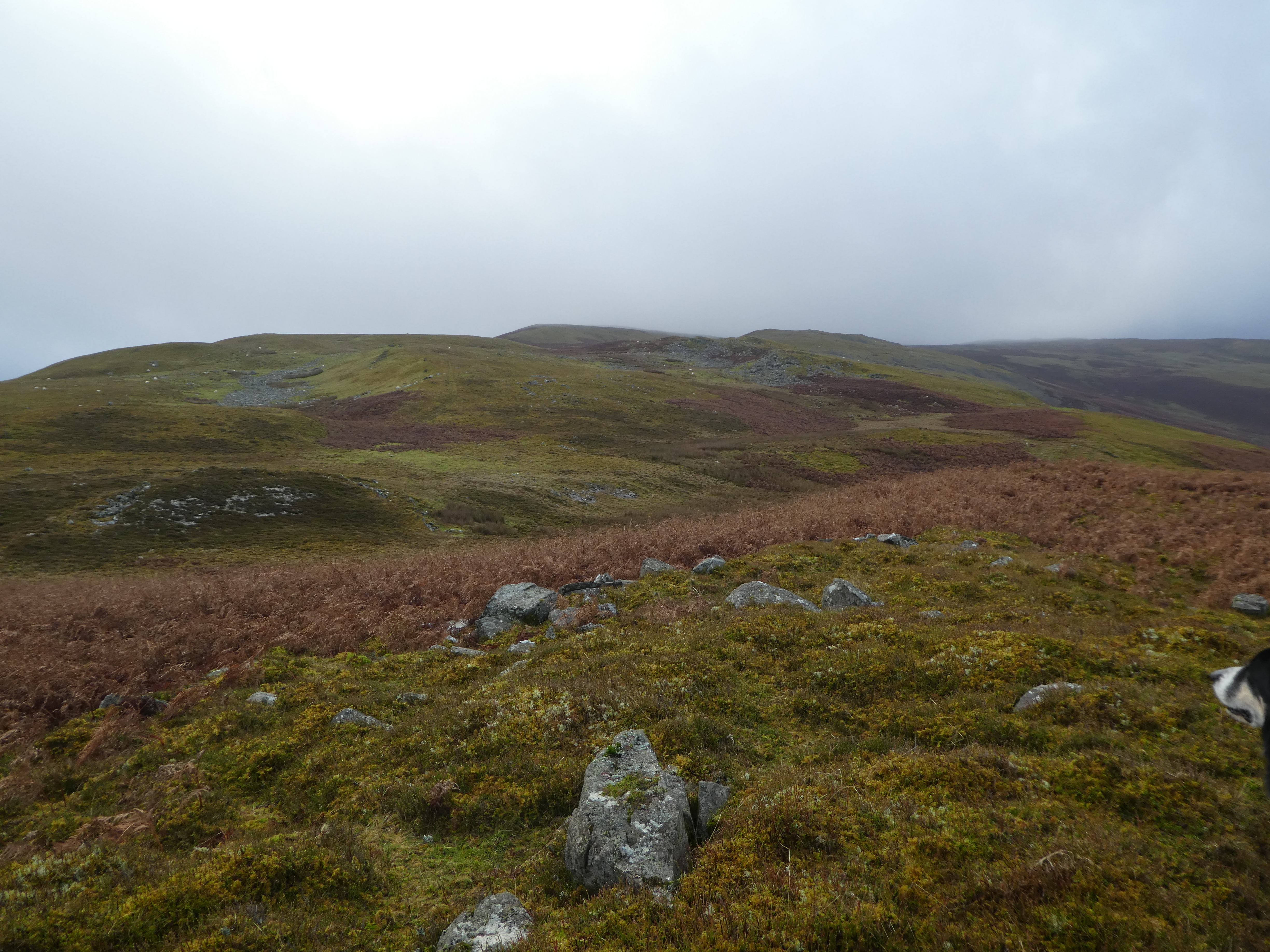
Up on the plateau/ ridge we could see the route following the bumps into the mist ahead. There was no defined path here and we followed sheep tracks keeping to the higher ground to avoid the boggy bits.
The next large bump required crossing a little dip and we kept left to avoid too much of the bracken belt,
Looking back we had stayed on the right hand side after the initial climb which brough us to the left a bit.
We were now following cairns on the ridge top - still with sheep tracks in-between,
The mist got a little thicker as we continued, with just a faint glimpse of the lonely trig point standing out ahead.  What you cant see in the picture is the boggy dip before it that we had to cross to get there.
The trig point was not on the highest point of Y Gamriw ...  it was the next lump which had the remains of a building on the top.
Dropping down to the col beyond - basically still heading away in the direction of the ridge, until we picked up another track that crossed the plateau curving around and back the way we had come.
We had now dropped below the cloud and could see where we were heading - across the col to the slope in front and up the marked track. However we had to follow the track across the intervening boggy bit
In exactly the same way as the previous ascent we followed the track up to the plateau where it mysteriously vanished and we then had to connect the bumps.
Looking across at the Y Gamriw part of the route,

Approaching the cairn on Drum Ddu, then looking along to the next top.
Reaching the end of this part of the ridge where it drops down to a saddle - we had been here last year walking up from Steph's. We had another area of boggy ground to cross to get to the left side.
As was consistent for today the path only showed itself off the side of the plateau. It then dropped steeply down into the bracken belt.
In the bracken belt the path then traversed across the slope just above the boundary of the open access area. 
The track then followed the side of the hill around until we were facing the wrong way, but it was the easiest way to gain access to the track below.
When the track came up to meet us we turned a sharp corner and returned down it. 
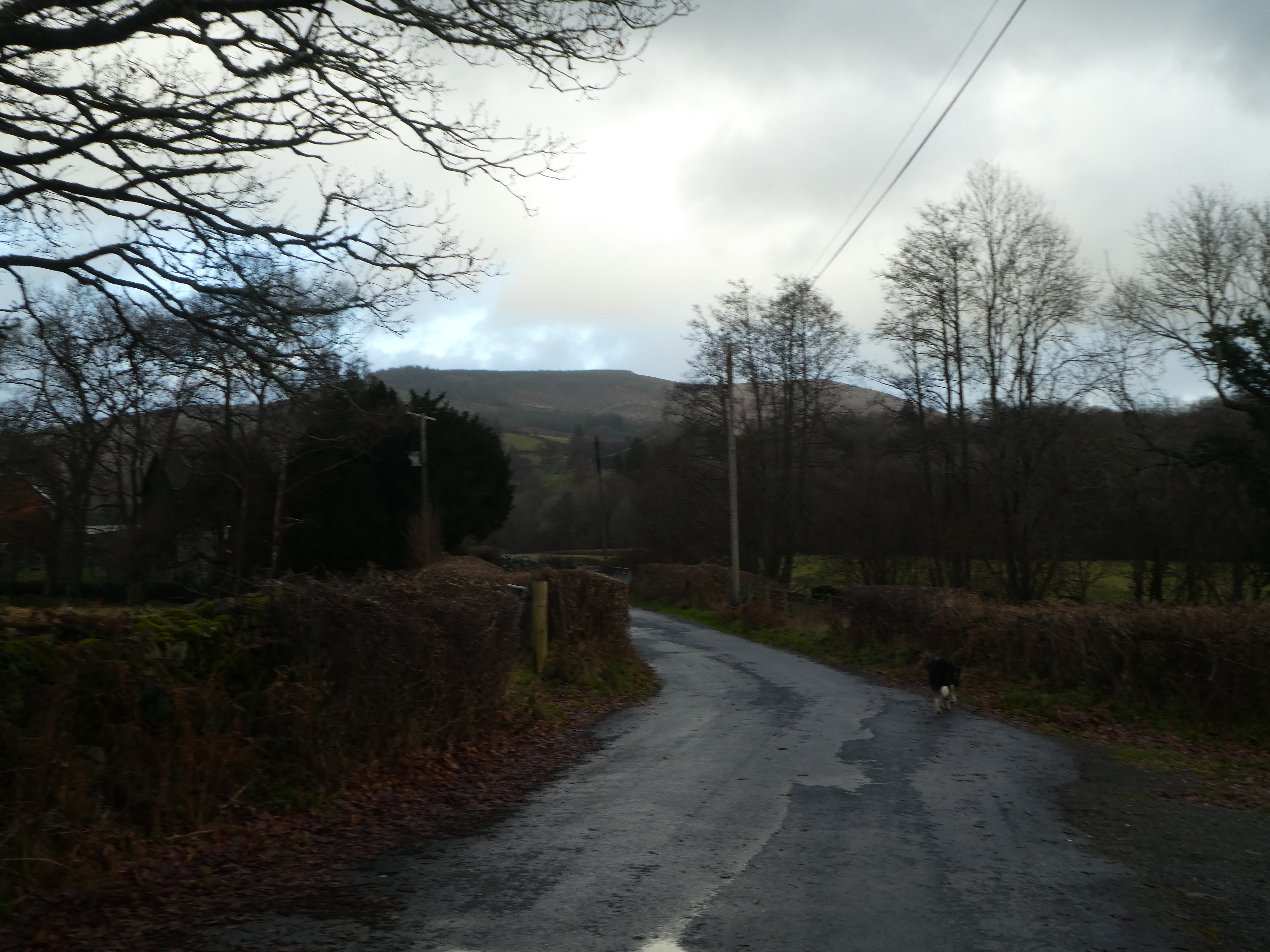
The track merged onto a back road which we followed as it wandered around following the general direction of the river Wye, although there was a lot of up and down.
The road was bounded by trees, so there were only fleeting views out until we were approaching the village. We arrived at the junction by the church and the car park.