A fresh morning, frost on the ground but initially a clear sky. Bertie & I
headed off to do the first part of Hangers Way from Alton to Selbourne. The
aim was to park in Selbourne village car park, walk up Selbourne hill and
across the common, working our way back to West Worldham, and up towards
Alton. Cross the A31 then turning around to pick up the first cross country
section of the Hangers Way, re-cross the A31 and along Neatham Down and on to
East Worldham. From here traversing King John's Hill and wood land to reach
Wick Hill hanger, continuing along Selbourne hanger and back to the car park.
We parked the van in the village car park, and set off (after a few worries
about where the free parking actually was as part of the car park is for Gilbert
White's house) up the track leading to Selbourne Common, and a climb up the
"Zig-Zag path". This path had been created by the aforementioned Gilbert White,
and made its way up a small swath cut in the trees, with multiple zigs and
zags.
Up on top of the hill looking back down tot he village, before continuing along
the top ridge
We set off west trying to find a path that would take us to Coneycroft hill and
a back road. After meandering around following various paths and game trails we
ended up on a bridleway curving down to the road.
We climbed the road until we could take a path across the fields
The path led across several fields before crossing the B3006 near Norton farm,
after which it turned north (still across fields)
We crossed the site of the medieval village Hartley Mauditt (after a false start
the wrong side of a fence and had to retreat) to the more recent hamlet of the
same name.
Through the hamlet and on to West Worldham before we could turn back out into
the fields once more.
We crossed through several more grass fields (and a large trench for the new
fuel pipeline to Heathrow) before arriving at the Kiln house. I am sure when
Fleetwood Mac stayed there to record their album of the same name it did not
have the huge barn constructions behind!
From the Kiln house we followed the drive, and chalk stream, back out to the
B3004. Under the A31before curving around and down the side of an industrial
area.
At the bottom of the industrial area we picked up the first rural section of the
HW (the bit to here from Alton station is all along the B3004). Unfortunately
the HW goes across the A31 once again and we had to dodge the traffic on the
dual carriageway - luckily it was not very busy. On the south side the path
follows a rising traverse along the side of Neatham Down.
Once over the shoulder we crossed two large crop fields towards a coppice marked
on the map as "earthworks" ... this was very extensive and high ramparts
hidden in a private woodland.
passing a converted Oast house and still crossing fields to Clay's farm.
The final section of fields brought us to the outskirts of East Worldham
village, which we bypassed using a footpath
Views from above East Worldham across to the hills between Liphook and
Haslemere.
Dropping down to the B3004 involved a large number of steps!
On the other side of the road we got the first sight of King John's Hill - a old
iron age fort and medieval hunting lodge. The path traverses over the shoulder
and on into wooded areas.
If the outward track was across fields the inward track would be through woods
and plantations (with a few clearing in between).
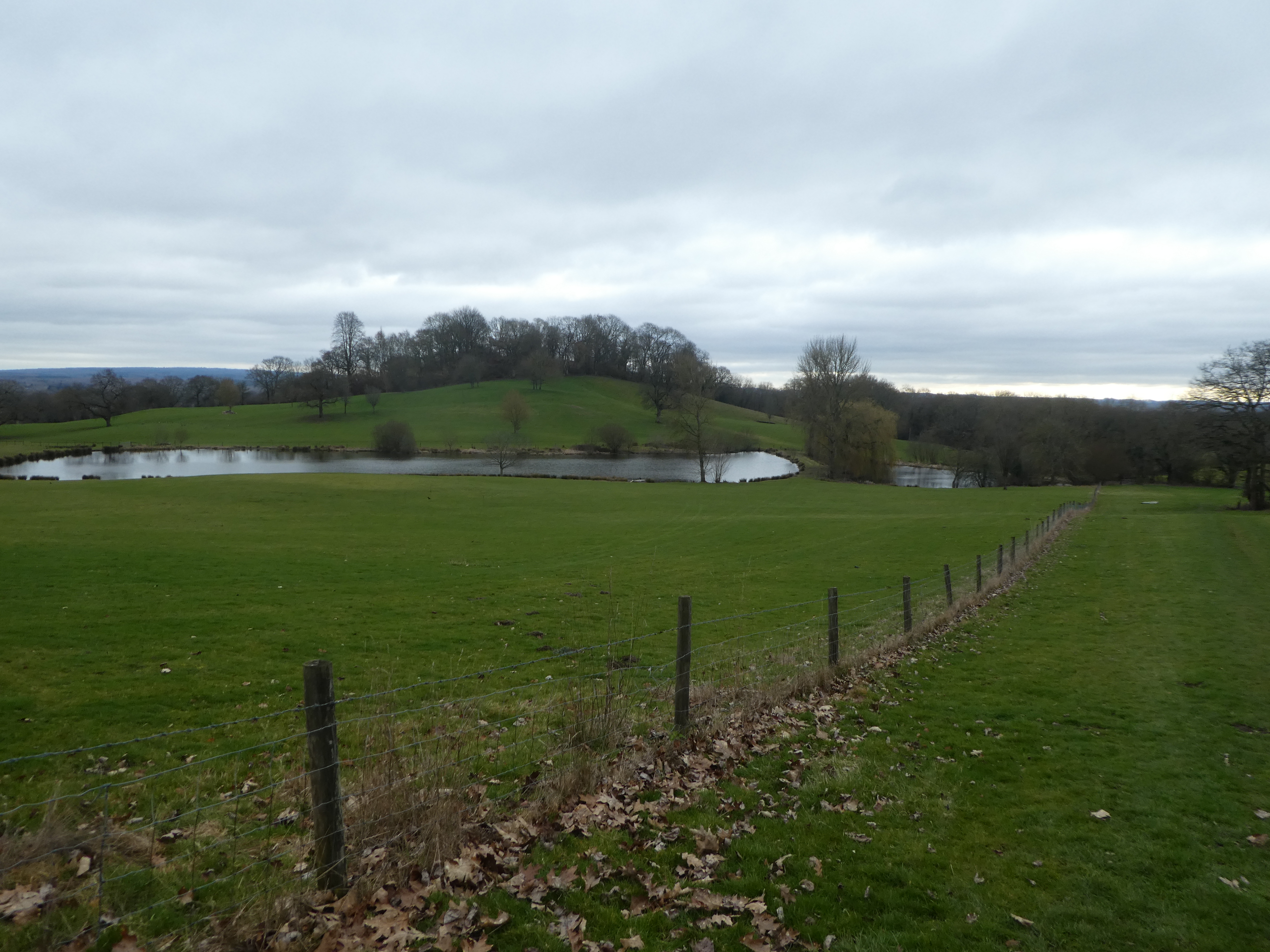
In Hartley wood the HW zig-zags around, even going three quarters of the way
around a large pond.
Across a back road and the into the real hangers... Along side Wick Hill
and a very steep slope to the right dominating that side.
As the hanger petered out we dropped down through the woods on a wide track - a
slight diversion from the HW.
Along the stream at the bottom and past several lakes brought us back to the HW which we could follow along Selbourne hanger.
Arriving at the village of Selbourne we had to climb up past the church to the main street. We were parked behind the pub and managed to avoid any diversions.