The rain of the previous few days has dissipated so an opportunity to get out.
I chose to go to Selsey and walk from Pagham harbour RSPB car park, because I
believed that the coast path would be shingle based and therefore slightly
drier than the fields. The idea was to go around Pagham harbour from the RSPB
centre to the spit beside Pagham lagoon. Walk around the spit if possible then
follow the beach all the way up to the holiday camp at Bognor Regis. Depending
on the tides would dictate whether we would be on the beech of the promenade
of a mixture of both. about turn there and back to the Aldwick area and cut
through the houses to pick up a path through the fields back to Sidlesham and
then return around the final side of the harbour to the car park.


The car park at the visitor centre was very busy (so there must have been some
"must see" birds in residence) and we had to park in the overflow car park. The
only space for the van was beside a huge muddy puddle and Bertie managed a face
plant getting out of the van which set the tone for the walk. We left out the
back of the car park onto the bridleway that ran beside the reserve and then
into some fields leading up to Sidlesham Quay. the path was fairly dry but the
field had some boggy sections which foretold of things to come.
Around Sidlesham quay and onto the path beside the harbour - this was really
muddy and with huge puddles that needed to be traversed. Definitely a bit of a
struggle to get around as we moved between the flood debris and the scrub
Around the top and eventually we arrived at Pagham wall - and an elevated (dry)
shingle track
The wall ended at Little Welbourne and we continued around the edge of the
harbour, which soon became a more stable path cutting around to the Holiday
village (row upon row of mobile homes all squashed onto a low lying field only
protected by a low berm from the sea.)
Across the dam at the end of Pagham lagoon where a pair of swans were using the
breeze to push them along.
At the spit there was a fairly good path across the maquis grass leading out to
the west end of the raise land. we followed it until it climbed up onto the
spit, but then saw that if we went any further it would curl around and we would
have to swim to get back.
We turned around at this point and and headed back to the harbour road at Pagham
along the top of the spit..
The beach was very stony so we stayed on the "road" - more a track passing the
first few houses, before making our way over to the beach at the first set of
road junctions. Still stony so we crossed over towards the water.
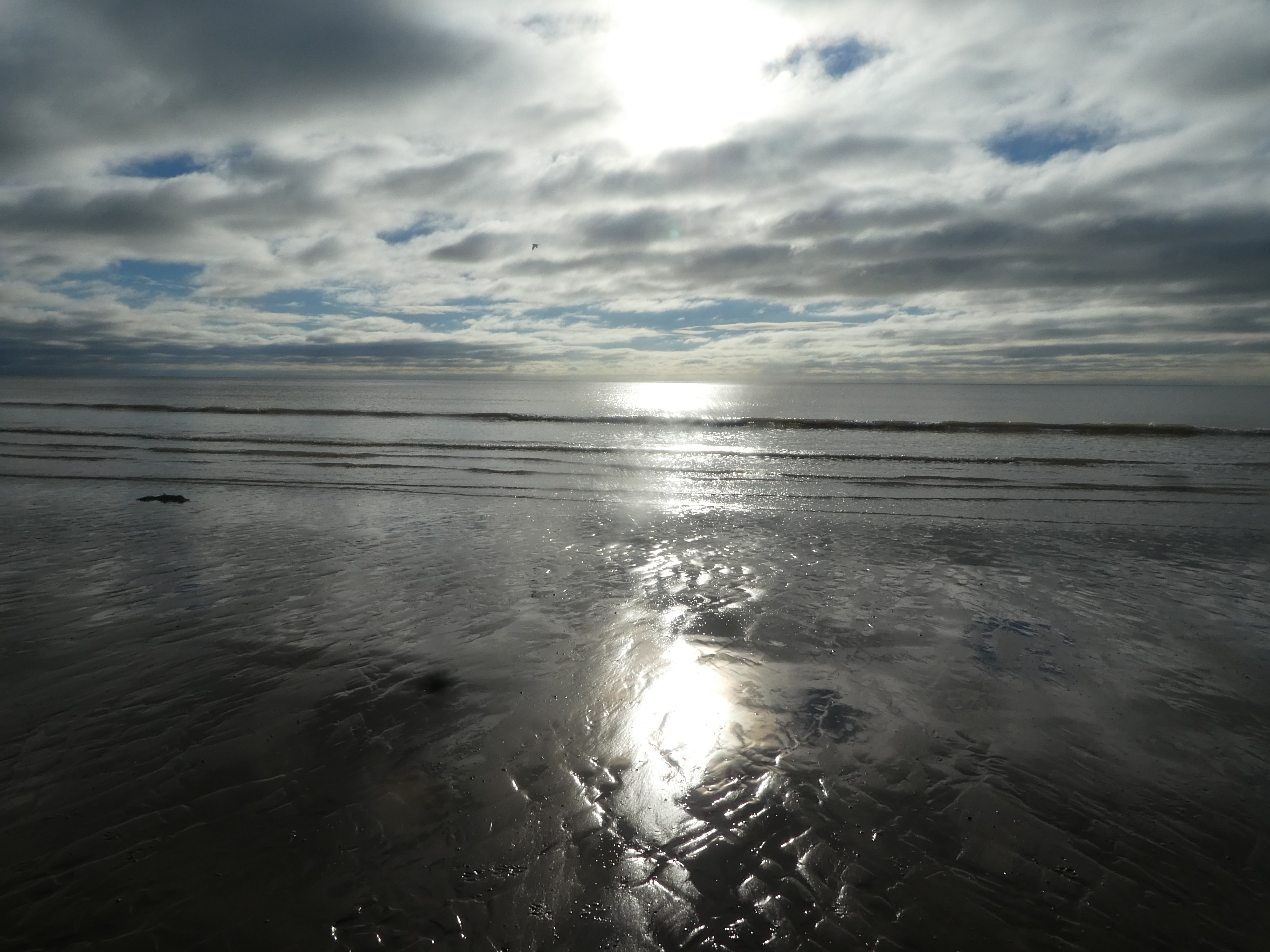
Down on the beach it was better, there was some sand between the pebbles giving
some support and we could make better progress. This was one long beach front
curving gently around from Pagham, through Alwick to Bognor.
The groynes were not much of a problem here as they were low and we could hop
over or go around. We also passed the remains of a Mulberry harbour section
.. not sure if it was a wreck or deliberate.
The sea was exceedingly calm and lapping gently, and as we crossed into Bognor
Regis became more sandy (or muddy depending on your version), but pleasant beach
walking.
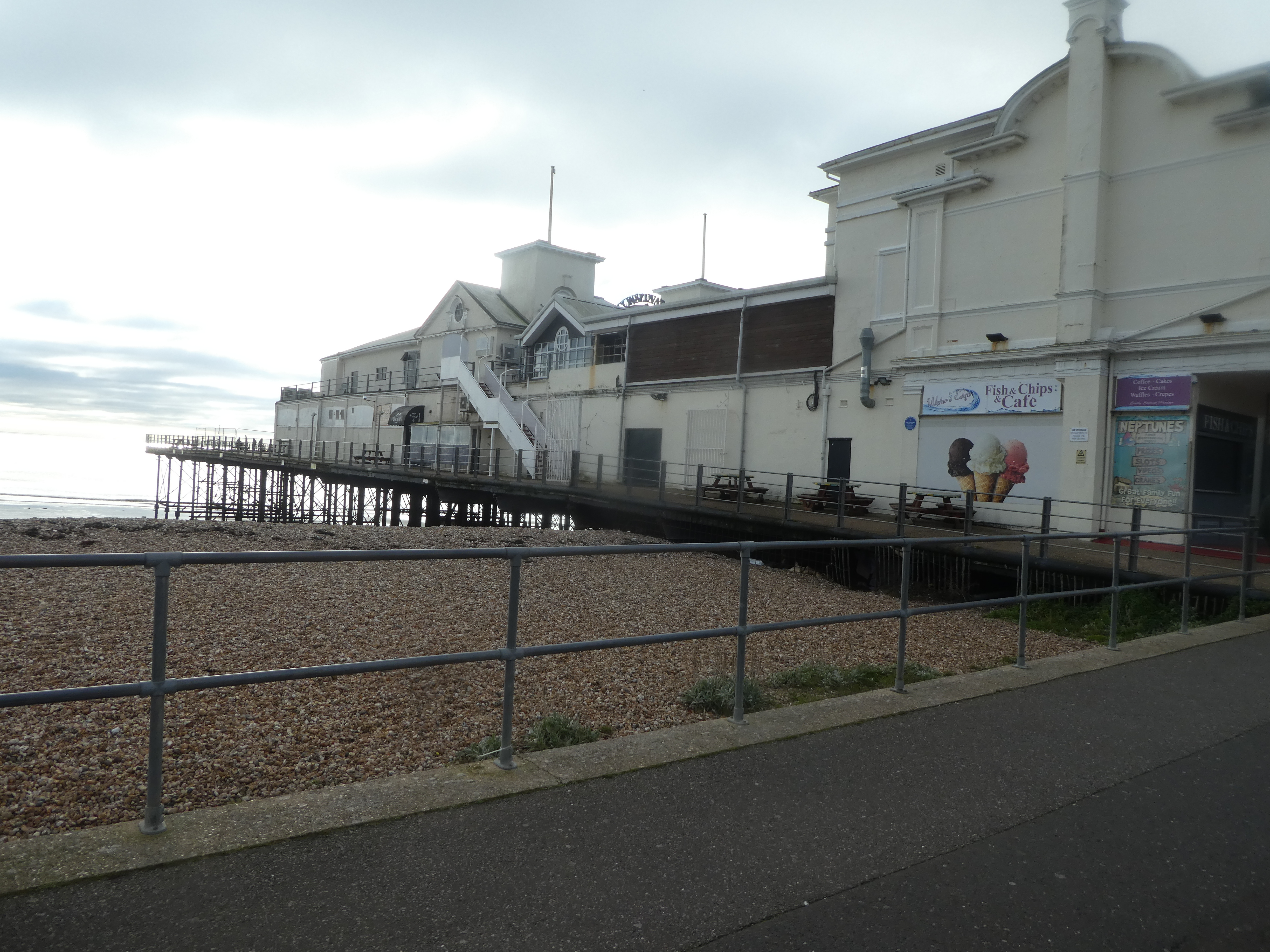
We past under the remains of the pier continuing along aiming for the building
with the glass tower attached - this marked the beginning of the holiday camp
area.
Opposite the holiday camp were a series of rock groynes marked with huge flag
poles, and we used these as the decision to turn up towards the promenade. the
points of the holiday camp arena showing over the skyline (the better view than
of the mess further up).
Back along the promenade ... the white line is where the tourist "train"
goes (only in high season) and past teh other end of the pier
The promenade continues (with teh train white line) up to where the beach huts
start then it becomes a choice between a seedy track behind the huts of a fight
on the shingle - we chose the former.
We left the beach following the English coast path that followed the road into
Aldwick, before breaking back through the residential areas to the beach. This
saved some shingle walking but did not gain much if anything. Back on the beach
we soon got fed up of the shingle and cut down onto the sand/ stone section
beside the water.
Further along the beach we cut back across the stones to pick up what was marked
on the map as a bridleway. However this is all residential area with lots of
keep out signs and paths blocked by locked gates. We ended up doing a circle
trying to find the correct path which eventually came out on the Pagham road.
Opposite the Lamb inn we turned down Summer lane, passing a huge new housing
area, before it turned into a farm driveway - although there was currently a
huge Southern Water treatment works ongoing down the lane.
After the treatment works we moved into the fields and a return to the boggy
patches. To make it slightly better we diverted up past a reservoir to reach a
second farm track - definitely drier.
We followed this lane down to Honer farm, where we turned back onto the original
route in a field below the farm. This climbed slightly away from the puddles.
Then it turned over a large grass field with some puddles, before crossing into
a second one that had stripes of streams crossing it - some of these came up to
almost the top of my gaiters, so when we reached the gate at the end I used the
gate bars to keep out of the deep water.
Drier now (but still with muddy patches we crossed a final field to come out onto Mill lane, and hence back to Sidlesham quay.
From Sidlesham quay we followed the "discovery trail" back to the RSPB visitors centres. This was parallel to our outward track but along the edge of this section of the harbour.