This months BOC retirees walk was around Puttenham common, starting at the largest car park and cutting around the Hampton estate, up to the North Downs way , and following it back to the pub in Puttenham. Finally back to the car park via the Fox way.
I was using the van for transport as Sue had the car today, so I could not park in the proposed meeting spot and had to find a car park without barriers, and had identified that a couple around Hampton Park did not, and chose Britty Wood a s suitable since I could walk over the fishing lakes and across the common to get to the meeting point. As it turned out the entrance to Suffield lane had "road Closed" signs on it and rather than face a multipoint turn in the road I chose to go around following Seale Lane/ Puttenham road/ Elstead road and Little road to approach the car park from the opposite side.I left the van tucked to one side in the car park and left down the road - I was sure there would be a footpath off to one side, but I could not see it at the start (I found it on the return later in the afternoon). At the Entrance drive to Hampton park estate I turned down the "anglers" path to the causeway between the two lakes.
Crossing the causeway and into the common on the far side.
The path followed the edge of the larger lake before cutting through the woods to the lower car park. From here I stuck to the large tracks that were heading towards the upper car park as they tended to be drier than the minor ones.
The final climb up to the car park involves a steep(ish) sandy bank, before the plateau above.
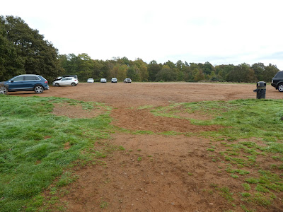
The car park looks out over Haslemere and Midhurst to the south downs, with Devil's punchbowl in the middle.
I then had to hang around for 30 mons or so for the other walkers to trickle in - the road closed had caused a lot of confusion and also reports that it was not really closed (at least not as far as the car park!). Once all gathers (12 of us) we set off out the in door as it were.Over Suffielkd land and down the side of the houses opposite to pick up a bridleway heading for Rodsall manor. At the manor the first navigational error brough a U turn to get us back on track.
Back on the prescribed track over to Cutt Mill House on a sunken track.
Just after the house we turned down a path beside the pond of the same name. Then through the woods on a path to avoid the muddy bridleway. and over the back road with a sharp turn onto a forest track.
Through the woods of Lower Puttenham common. Here we corrected onto the GPS track, however it appeared the recce had taken a shortcut here to miss the car park and cross directly into Britty Wood. I took everyone up to the car park on the GPS track - also checking the van was still there!). Through Britty Wood on wide forest tracks to Cross Seale road into an unmarked car park.
There was a dog walker with 6 or 7 dogs out of control in the car park that caused numerous comments about leads especially as one dog was very menacing. However we continued away from the mayhem up the track alongside Crooksbury common.
Over Littleworth road into the trees beside Farnham golf club. We followed the fence as it meandered along the edge of the fairways and into Binton Wood. We turned along the northern edge of the wood to come back towards Elstead road, before dropping out into the top of a series of fields.
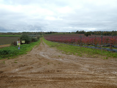
The fields had been extensively upgraded with enhanced irrigation and well ordered fruit bushes (blueberries and raspberries). We followed the path along the hedge between the fields and up to the North Downs way. Now were would follow this trackway along the "ridge" to the pub.
The NDW climbs slightly to give a view along it towards Guildford, before dropping into Totford Wood and across the stream that feeds the fishing lakes (also the other entrance to the Hampton estate.
From Totford Hatch we climbed steadily up the north end of Puttenham common - the last climb before lunch. From here we dropped down onto Lascombe land and into Puttenham before arriving at "The Good Intent" for lunch.
The usual 90 mins or so for lunch - I had a Cajun chicken bun - before the cats were all herded for the short return to the car park.
Across the street to pick up the Fox way as it dropped down slightly to more ponds before rising again between fields.
A very muddy crossing of a stream beside Lydling farm and a gentle climb between more fields heading directly for the car park.
Re-joining our outward trace close to the car park entrance and the end for everyone else. After the goodbyes I set off down the sandy band to way I had arrived this morning.
I returned a slightly different way (trying to find a more direct path, as I was conscious that the light would soon be fading. However as it turned out the map was not that accurate and I made it up as I went along ending up where I needed to be - at the causeway.
Over the causeway and up tot eh anglers parking, then across to the path I had missed this morning that avoided walking along the road. This came out nearly opposite the car park, so a short way along the riad and I was back at the van. Home as it was getting dark.


