We are in a lull between weather systems, and today was going to be another sunny day. Too good to miss out, so I planned a walk on the South Downs. The idea was to start at the Cocking hill car park, and follow the SDW to the devil's Jumps, then turn down to the pub at Hooksway. Next back around Phillis wood and along to Yew tree cottage. Up the track into Linchball wood and back to cross the SDW dropping to Henley Lane, hence to Cocking village. Finally up the farm track to Hill barn and back to the car park.
I parked up in the car park beside the A286, alongside a couple of other cars - one with two walkers I would catch up later, and a runner who would pass me on the climb.
Leaving the car park and up the drive way to Hilltop farm, passing the café, and throguh the farm yard.
Up Middlefield lane between high hedges, to a junctions of farm tracks. Here the SDW continues on a chalk track past a large chalk ball.
The top of the downs here is a series of rolling bumps and troughs.
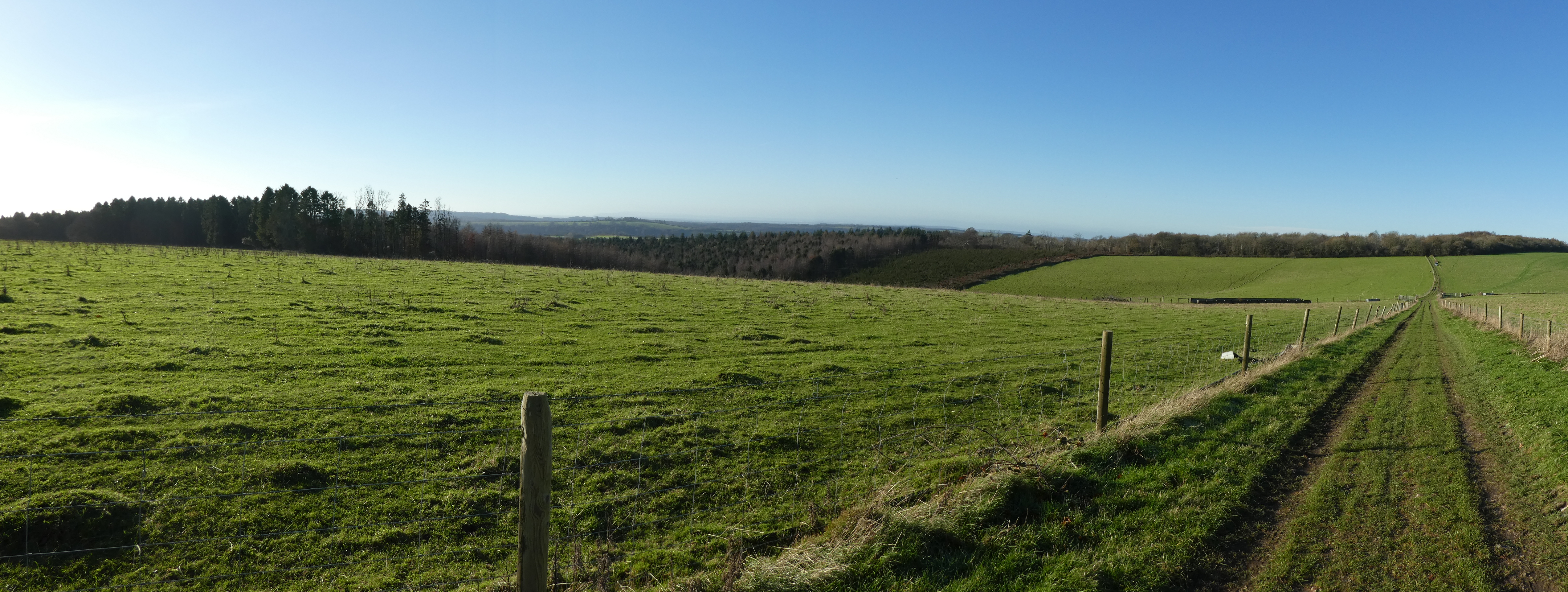
At teh large seating area at the top of Lynch Down looking north
Then slightly further along looking south.
Into the woods behind Monkton house and around to the Devil's Jumps - seen through the hedge.
Through the gate to the field holding the tumuli - Four larger ones and a smaller on the far end. I think there are several other less distinct as well. I walked up and down them all in the line.
At the end looking past Beacon hill to Petersfield. Leaving the field containing the Jumps, and continuing down the track leaving the jumps and dropping down the south side.
At the pub (currently closed) in Hooksway, taking the bridleway just past it that curved around Phillis Wood
Half way through the wood I headed towards Stubbs copse from a cross roads of paths. A zigzag at a grass field, crossed over to more trees
Climbing away from the field where the track levelled out and continued between hedges down to the driveway from Brooms farm
Down the back road which curved around to Yewtree cottage. At the sharp bend just past the cottage I took the permissive path up a forest track
At the edge of Linchball Wood the path follows the edge of previous harvesting around more mature trees - last time I was here it was a little confusing as to where the path went. The path had changed from what is on the map and now follows a forest track.
At a junction I continued up the slope beside new plantings up to a multiple path junction. Here I followed the path that contoured around a coombe.
The path descended a little before climbing back up. At the next junction I turned north to cross the SDW
Over the main path and down a forest track on the north side - this chalk track dropped down gradually contouring around the end of Stead Combe.
The chalk track merged into Henley lane and continued its gradual descent.
Another track junction where I continued north to reach Bell lane. Turning towards Cocking village and under a disused railway bridge. Part way into the village I took a path behind some houses
The path came out beside the Cocking history pole.
(A column containing 48 low relief bronze panels that wind their way downwards in a spiral recording history from the Bronze Age at the top to the Millennium at the bottom. Twisting around the column between the panels is a narrow ribbon of national history giving context to the Cocking events. Beneath the column on the Portland stone base are inset two bronze relief parish maps facing north and east.)
Over the A286 an down church lane (and path) to reach the church, and then the back lane climbing up. It is always wet here as it collates water from several streams.
Climbing up the lane to reach Hill Barn farm and the SDW.
Then down the drive way back to the car park on the other side of the A286. The car park was full when I got there - it was obviously a good place on a sunny day.