After yesterday's wind and rain today was a complete opposite - sun and very cold. I planned a route up on the South Downs to avoid any effect on the paths from the prior rain. This was a good decision since the Arun river had flooded at Newpound. I would go up to the car park at Bignor Hill, then drop south below Great down then turn west crossing the A285 beside Eartham wood. North to Selhurst Wood, continuing up to the South Downs, before turning around and dropping to Upwaltham, over the A285 once again before climbing the other side to return to the car park.
The road up to the car park was slightly greasy (or it could have been ice remnants) and when I reached the car park there was only another van - probably spent the night up there!Leaving the car park and heading down to the Monarch's way.
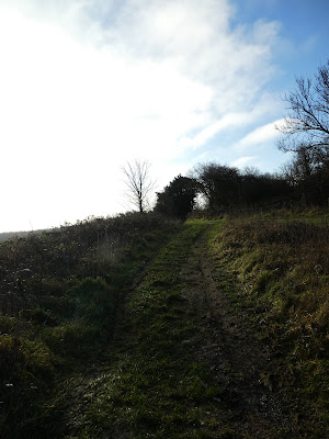
Along the greasy (there were puddles, but no quagmire) track to Gumber Corner, where I turned south along the trees, coming pout into the sheep field of Great Down.
Along the down to the gate at the point of the field. Here I did a U-turn up the track along the other side of the fence to pick up a forestry track - same conditions as the previous one. This took me in a direct line west.
The track dried up in a small wood, before going up the side of an open access wild cattle field.
Into Eartham woods still heading due west through the changing tree plantations. The track also undulates quite a bit over valleys and ridges.
Meeting back up with the Monarch's Way as I was coming to the end of the woods, and along the back road beside the rough. Then dropping down to cross the A285.
Now int he large fields of Selhurst Park farm, still on the Monarch's way. the track zigzags around the field edges heading for the woods on the skyline.
The path crosses the final field - there is absolutely no trace of it, luckily it was not swampy and I could cross the flints. Over the back road and into the Selhurst Park woods.
Dropping down through the woods on the forest tracks dropping down to the valley at Droke. Over the back road and up a very steep path between hedges to the woods of North Side.
The track continues climbing (at a less steep angle) into the woods - initially mixed trees and clearings.
Then more of a plantation through Oxen down and up to a hidden plateau.
At a complex junction I turned east along the top of this bit of ridge, to the edge of the woods.
Here I turned down the side of Heath Hanger. The map showed the path in the trees, but that was overgrown and I kept to the edge of the grass swathe over Heath Hill
At the end of the hill where it dropped steeply down to Upwaltham, I stayed onthe farm track (probably too far as I ended up going through the farm yard onto the road past a "private sign" that faced the wrong way.
Back over the A286, and around the gardens of the houses there - the path follows the fence line inside the gardens. Then steeply up a grass path climbing up to Upwaltham hill between sheep fields.
At the top of the hill, things levelled out beside crop fields (and a memorial to a crashed Dakota) to reach a complex junction of paths in west woods.
Through the woods and out onto the path heading due East.
Back on the greasy tracks contouring across the southern side of the ridge top passing the aerials
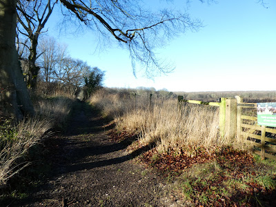
The last section back to the car park was along a forest track that came out just below the car park, which was now a lot more busy than when I had started out,


