Another sunny day and we had found a "tourengeher" route just off the ski area
of Spitzingsee, so we planned to see what the snow cover was like, and if it was
possible. This was over an abandoned ski lift (only works in the summer now)
that climbs up from the lake to the peak of the same name as the lift.
We arrived at the bottom and parked in the old lift car park (5 Euros for the
day) and could see that there was still a ribbon of snow down to the car park in
a gully where the track was indicated to go. This was a well used ski touring
track as there were adverts for night skiing and also a transceiver testing
station at the start.
We were a little concerned as the only other people in the car park were setting
off to walk the route - just in walking boots. Although we did see several later
with snowshoes and others with crampons.
With the hard frost over night and the steep nature of the track as it climbed
up the gully, we fixed the harscheisen on at the start - it was a good decision
as we soon needed them. The track ran up the steep gully to a small ledge which
gave some relief before continuing up a n even steeper section - here the issues
were compounded by the hard frost icing up the well scraped surfaces, and we had
a few moments of panic when the skis slid slightly before the crampons caught -
usually due to the very hard ice not giving in to the steel of the crampons.
At the top of this section the snow ran out and we had to remove the skis to do
a dog leg over to a new meadow.
This one climbed up almost as steeply before easing up as we got higher. the sun
was just cutting over the trees onto the side of this section.
At the top of this slope there was a footpath going away to the left (a separate
route) but this was very green, and we kept to the original track, which curved
around some trees and then seemed to head down hill.
After an investigation down the track a little way so we followed some (many
pairs) of footprints in the edge of the trees and along a forest track.
Unfortunately this was devoid of snow so we had to carry the skis for a
while.
This track joined back with the swathe after it had come back up - this would
make the descent more smooth if not more work.
Now we could see the final slope rising from a hanging valley ahead of us, from
here it looked as steep as the start section, however as we got closer it
lessened to a more acceptable slope.
To reach the bottom a small stream crossed the swathe - note to self .. this
would need care on the descent. Onwards to the top slope.
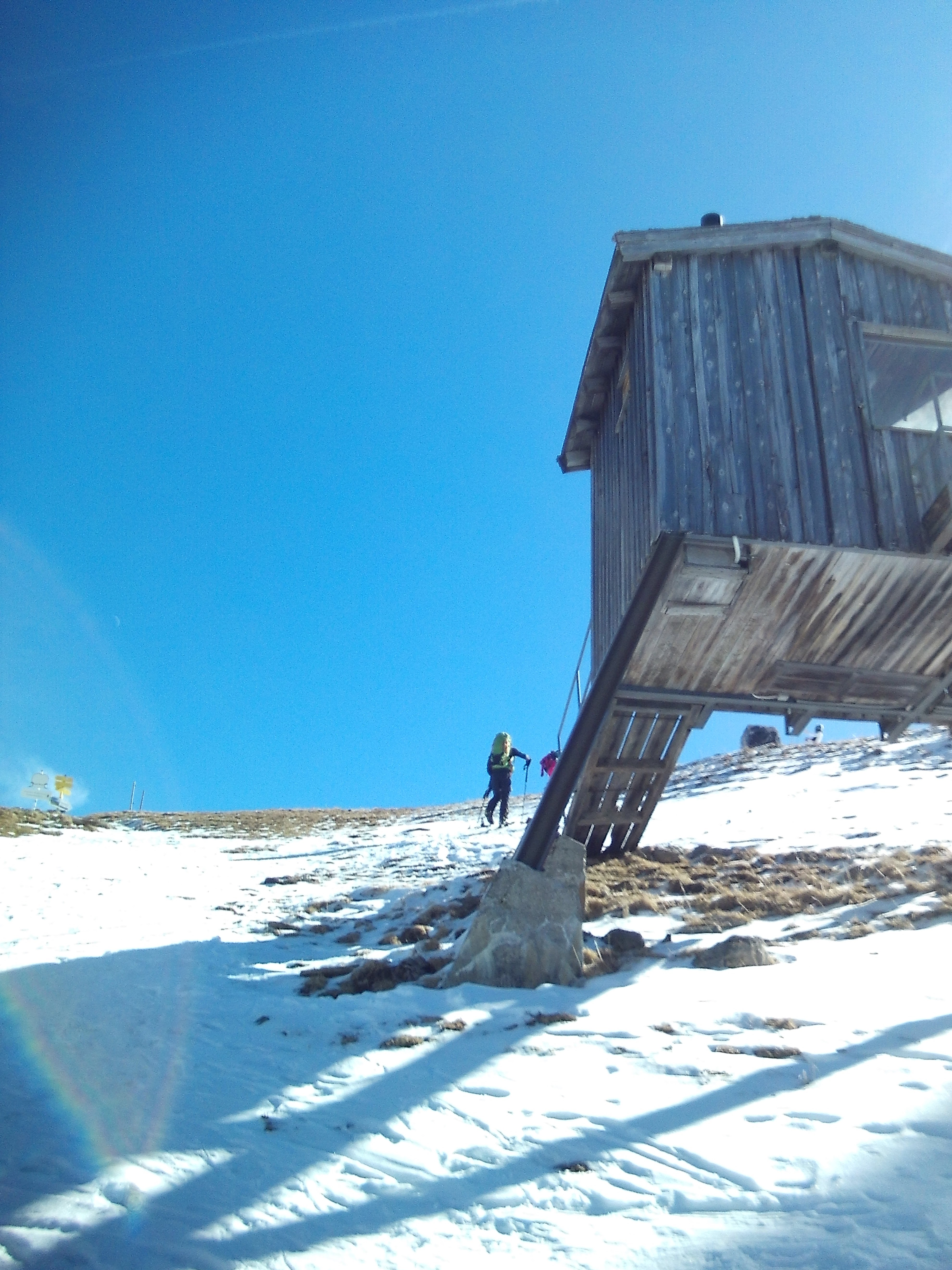
We climbed up this open slope aiming for the little hut we could see near the
top.
As we got closer you could also see the top station of the cable car.
A final effort brought us to the ridgeline, and a view over it to the Alm of the
same name.
We then finished up to the cable car station
Looking towards the Gasthof
Looking down towards Spitzingsee and a second obsolete ski lift.
Looking around and after walking all around it settled down in the sun for a
snack.
Looking at the rocky peak behind the station (the cable car was named after it).
There was a well used track running into the trees here that went up to the top,
so after eating we left the skis at the station and climbed up the icy snow
covered path
It was very tight in the trees and plenty of rocks showing through so was
definitely not a ski trail (although you could see some had done it!).
Out of the trees we can to the far side of the rocky top and the trail got
narrower and steeper, with snow covered packed down to hard ice. This was right
on the limit for us as we did not have crampons, however Bryon made a great
effort to widen steps for Steph and I to follow up.
An even tricker last section to the top had a steel rope hand rail.
So to the summit cross.
Over Spitzingsee to the West
The Green hills to the East.
Three monkeys on the top!
We actually found a slightly steeper descent, but this had much less snow and
more rocks. This dropped us to the col behind the peak and we could easily
re-join the ascent trail at the point where it got steep.
Back down to the cable car station, and recover the skis, to prepare for the
descent.
The first section was really good snow - the sun had softened the tops and apart
from a few harder bits left by previous descenders spray that had frozen really
hard over night, it was a joy to ski.
This slightly degraded as the slope eased towards the bottom of this bit, but
generally good.
Down onto the hanging valley section and a speedy crossing to gain height on the
far side, only just remembering the stream that crossed as we jumped it!
Now we had to climb the gentle slope - this time following the swathe and remain
on snow, polling and skating to get to the top of it and the second slope down
to the cleared track on the dog leg. This was less sun softened (even though it
was lower, it was protected by trees on each side). there were also some added
"interest" from rocks and debris showing through making the track to follow more
challenging.
Around the dog leg and onto the final slope - this had not been softened at all,
and we had a steep mogul field to negotiate with bare patches to avoid. However
no significant challenges and we were soon back down the car park.
Lots of sun to dry out the skis and boots before returning to the apartment. On the way back we took a diversion across the river Inn to the Austrian side to see if there were any possibility of routes on that side (subject of the next entry)