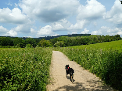
Leaving up the wide and paved track up between barley fields. This "approach" track went in an almost directly northern tack, through a belt of woods until it met the start of the vale reserve itself - the wooded sides of a bowl up to a ridge line slightly disconnected from the south downs ridgeline.
There were a numbered series of posts to guide the most effective trail
through the groves, which started on the main track before diving off into the
shrubs at the side. This then led through a series of clearings around
extremely ancient yew trees. All magnificent in their poses.
Each time it came back to the track you could get a perspective of where you
were in relation to the ridge ahead, before diving back into the shrubbery.
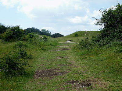
All of a sudden the trail comes out in the bowl where the ancient settlement
was discovered, rising up to the ridgeline ahead.
In the middle of this bowl, hidden behoind a copse of trees was a dew pond - sufficient for Bertie to cool off before the climb up to the ridge.
The track took a circular approach, rather than the direct climb of many steps
up the central open slope.
This track disappeared into the wooded slopes - these turned out, quite eerily, to be close yew plantations - very dark and close with very little light for other plants to grow.
With all the ascent being in the close confines of the yew forest, there was not much of a view until we reached the ridge line and cut across to the more open swath cut down to the bowl
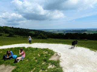
Looking down the central swath to the bowl below and back to the carpark in the distance, as well as up tot eh top of the ridgeline and the two most obvious of the four devil's humps - bronze age burial mounds.
on the humps, and looking back along the line of the four.
Back into the yew forest for the descent back to the entrance to the vale ... a wider track and more open than the ascent, as it cut through the yew plantation and the shrubbery around it. Very quickly we were back at the start of the trail 25 marker posts in total - 19 on the ascent but only 6 on the descent perhaps indicating the more simpler route.
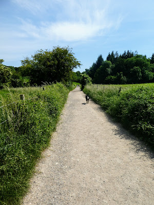
That only left the return to the car park along the farm track.
This track disappeared into the wooded slopes - these turned out, quite eerily, to be close yew plantations - very dark and close with very little light for other plants to grow.
With all the ascent being in the close confines of the yew forest, there was not much of a view until we reached the ridge line and cut across to the more open swath cut down to the bowl
Looking down the central swath to the bowl below and back to the carpark in the distance, as well as up tot eh top of the ridgeline and the two most obvious of the four devil's humps - bronze age burial mounds.
View south from the humps looking to the coast where we had been earlier and
around to Portsmouth harbour.
on the humps, and looking back along the line of the four.
Back into the yew forest for the descent back to the entrance to the vale ... a wider track and more open than the ascent, as it cut through the yew plantation and the shrubbery around it. Very quickly we were back at the start of the trail 25 marker posts in total - 19 on the ascent but only 6 on the descent perhaps indicating the more simpler route.
That only left the return to the car park along the farm track.


