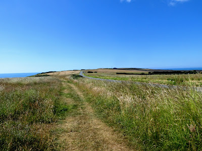
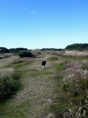
Bertie and I set out early, so we could avoid the hottest part of the day, I had planned to do the last section of the South Downs Way from Eastbourne to Exceat over the seven sisters. To make it a circuit (and to save the parking fee) I had worked out a route starting at a NT car park just south of East Dean down a narrow lane, heading east to the golf course before dropping down to Beachy Head. Along the coastal cliffs past Belle tout lighthouse and Birlin Gap and over the seven sisters to the estuary of Cuckmere haven. From here I would see how the land lay to get back o the van - no obvious trail but some open access land and experience led me to believe there would be a way.
Parking in the extended lay-by car park, and getting our ticket using the NT card, we took the footpath into fields at the beginning of the carpark.The footpath deviated from that on the map and did not cross the field but go both ways around it. We went right, and down at the end.
The path came into the old part of the East Dean village, crossing past the Tiger Inn pub and car park, and up Gilberts drive to the main road,
Along the main road until we could leave down Downs view lane, which changed into a footpath at a sheep shed after passing the houses
The path rose up a shallow valley, winding slightly heading for the shrubbery on the skyline. This was Eastbourne golf course.
The path through the golf course was concrete up the hill, then turning south on a grassy path
Over the main road and staying on the ridge climbing slightly to the trig point with views over Eastbourne to the left
Bertie had a quick swim in the pond on the top to cool off, and we continued to contour around towards the coast.
Touching the beachy head road at the point where it meets the road from the town below. then following the edge of the downs working up to the trig point at the buildings of Beachy Head
Climbing the final slope up to the trig point beside the visitors centre on top of beachy head. Looking down the cliffs showing the route onwards.
Belle Tout lighthouse below, where we will go next, after the view point on the head.
Looking along the edge, we passed two "Pastors" here, looking for people in distress.
Looking down to the beach below, but we kept away for the rest of the walk as Bertie was too interested in getting down.
Continuing down to the dip before the rise up to the former Lighthouse of Belle Tout
The climb up to the lighthouse was quite steep, but the view over the top onward was excellent showing the seven sisters and the cliffs beyond Cuckmere haven.
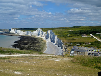
We dropped down to Birling Gap, with the views along the Seven sisters beyond. The facilities at the gap were full of visitors, and we continued on quickly, climbing up to the first of the bumps.
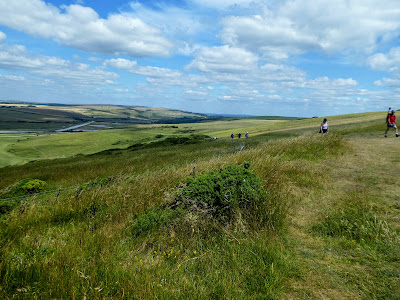
Up and down over the seven bumps between Birling Gap and Cuckmere Haven the breeze was welcoming as we hit the top of each one
The view over Cuckmere haven and along the coast towards Seaford Head
From the top of the last sister, we continued on the SDW as it descended on a gentle curve down towards the Cuckmere river. We could have dropped steeply down and then along the river, but remained on the SDW. Looking up the estuary towards Exceat.
The view back to the estuary and some of the WWII emplacements.
After touching the flood plain we climbed again staying on the SDW rather than following the river. We could see the car parks at Exceat.
Now was time to look for a path heading back to East Dean. There was a trace climbing up away from Exceat that paralleled the road, but int he open access land. Over the brow of the nearby hill showed the grassland heading away to the skyline.
At the end of the open access land the path continued through the same landscape but no longer open access, however it looked as if this was permissive as there was a pedestrian gate.
The path we were following ended at a gate onto the main road, however on the other side was a bridleway marked on the map ... so I was obviously a well used track. The bridleway led into the woods and turned parallel to the road.
Keeping int he woods the path turned first away from the road, before coming into the village of Friston opposite the lane with the car park. Heading across the main road again and going down the lane to the car park. Back at the van for food and refreshment then back to Uckfield (with a stop for ice cream on the way back in the outskirts of Eastbourne).


